Maopai geodata
Maopai (Jiangxi) is a seat of a fourth-order administrative division; located in China in Asia/Shanghai (GMT+8) time zone. In our database, there are 1268 cities with bigger population. Compared to other cities in China, 76.1% of cities are located further ↑North; 63.1% of cities are located further ←West and 50.5% of cities have higher elevation than Maopai. Note1


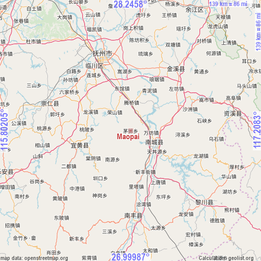
Maopai GPS coordinates[2]
27° 37' 28.596" North, 116° 30' 18.612" East
| Map corner | latitude | longitude |
|---|---|---|
| Upper-left | 28.2458°, | 115.80205° |
| Center: | 27.62461°, | 116.50517° |
| Lower-right: | 26.99987°, | 117.2083° |
| Map W x H: | 138.5×138.5 km | = 86.1×86.1mi |
| max Lat: | 53.31946° ⇑76.1% North |
| Maopai: | 27.62461° |
| min Lat: | ⇓23.9% South 18.22056° |
| min Long | Maopai | max Long |
| 75.07348° | 116.50517° | 134.28917° |
| W 63.1%⇐ | ⇒36.9% E |
Elevation
Elevation of Maopai is 160 m = 525 ft, and this is 324.8 m = 1066 ft below average elevation for this country.
| Max E: |
5622 m = 18445 ft | 50.5% |
| Avg. | 484.8 m = 1591 ft | |
| Maopai | 160 m = 525 ft | |
Min E: |
-3 m = -10 ft | 49.5% |
See also: China elevation on elevation.city.
Geographical zone
Maopai is located in North temperate zone (between Tropic of Cancer and the Arctic Circle). Distance of this Northern Tropic circle is 465.6 km =289.3 mi to South.| Distance of | km | miles | from Maopai |
|---|---|---|---|
| North Pole | 6935.5 | 4309.5 | to North |
| Arctic Circle | 4329.6 | 2690.3 | to North |
| Tropic Cancer | 465.6 | 289.3 | to South |
| Equator | 3071.6 | 1908.6 | to South |


Nearby cities:
15 places around Maopai: (largest is in red/bold)
• Dengfang
20.8 km =12.9 mi,  5°
5°
• Dongguan
23 km =14.3 mi,  348°
348°
• Hebu
21 km =13 mi,  329°
329°
• Jianchang
15.2 km =9.4 mi,  119°
119°
• Lixi
13.6 km =8.5 mi,  271°
271°
• Longxi
23.6 km =14.7 mi,  294°
294°
• Nanyuan
17.9 km =11.1 mi,  212°
212°
• Shimen
22.9 km =14.2 mi,  41°
41°
• Taobei
23.1 km =14.4 mi, 272°
• Tengqiao
15.2 km =9.4 mi,  1°
1°
• Tianjingyuan
17.4 km =10.8 mi,  126°
126°
• Wanfang
11 km =6.8 mi,  95°
95°
• Xinfengjie
23.5 km =14.6 mi,  159°
159°
• Xujia
18.5 km =11.5 mi,  81°
81°
• Zhuliang
19.8 km =12.3 mi,  151°
151°
Sources, notices
• [Note1] Compared only with cities in China existing in our database
• [Src1] Map data: © OpenStreetMap contributors (CC-BY-SA)
• [Src2] Other city data from geonames.org with taken over terms of usage.
• [Src3] Geographical zone / Annual Mean Temperature by Robert A. Rohde @ Wikipedia
