Tengqiao geodata
Tengqiao (Jiangxi) is a seat of a fourth-order administrative division; located in China in Asia/Shanghai (GMT+8) time zone. In our database, there are 1268 cities with bigger population. Compared to other cities in China, 75.4% of cities are located further ↑North; 63.1% of cities are located further ←West and 63.7% of cities have higher elevation than Tengqiao. Note1


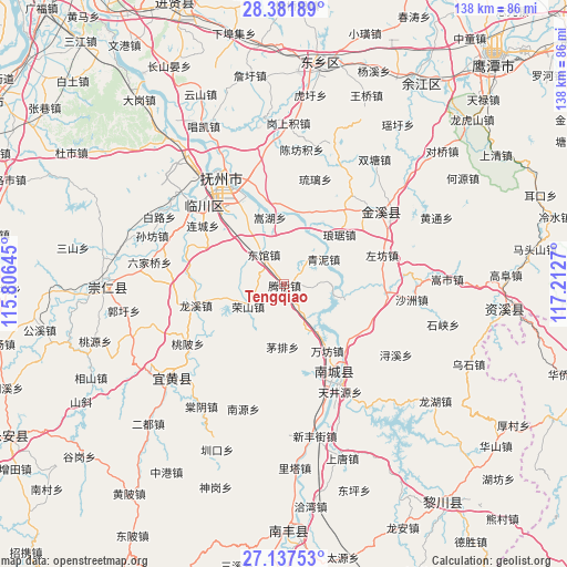
Tengqiao GPS coordinates[2]
27° 45' 41.364" North, 116° 30' 34.452" East
| Map corner | latitude | longitude |
|---|---|---|
| Upper-left | 28.38189°, | 115.80645° |
| Center: | 27.76149°, | 116.50957° |
| Lower-right: | 27.13753°, | 117.2127° |
| Map W x H: | 138.4×138.4 km | = 86×86mi |
| max Lat: | 53.31946° ⇑75.4% North |
| Tengqiao: | 27.76149° |
| min Lat: | ⇓24.6% South 18.22056° |
| min Long | Tengqiao | max Long |
| 75.07348° | 116.50957° | 134.28917° |
| W 63.1%⇐ | ⇒36.9% E |
Elevation
Elevation of Tengqiao is 79 m = 259 ft, and this is 405.8 m = 1331 ft below average elevation for this country.
| Max E: |
5622 m = 18445 ft | 63.7% |
| Avg. | 484.8 m = 1591 ft | |
| Tengqiao | 79 m = 259 ft | |
Min E: |
-3 m = -10 ft | 36.3% |
See also: China elevation on elevation.city.
Geographical zone
Tengqiao is located in North temperate zone (between Tropic of Cancer and the Arctic Circle). Distance of this Northern Tropic circle is 480.9 km =298.8 mi to South.| Distance of | km | miles | from Tengqiao |
|---|---|---|---|
| North Pole | 6920.3 | 4300.1 | to North |
| Arctic Circle | 4314.4 | 2680.8 | to North |
| Tropic Cancer | 480.9 | 298.8 | to South |
| Equator | 3086.8 | 1918 | to South |


Nearby cities:
15 places around Tengqiao: (largest is in red/bold)
• Chonggang
21.3 km =13.2 mi,  321°
321°
• Dengfang
5.7 km =3.5 mi,  15°
15°
• Dongguan
8.8 km =5.5 mi,  326°
326°
• Hebu
11.3 km =7 mi,  285°
285°
• Huwan
18.1 km =11.2 mi,  12°
12°
• Liancheng
24.7 km =15.3 mi,  306°
306°
• Lixi
20.4 km =12.7 mi,  223°
223°
• Longxi
22.4 km =13.9 mi,  256°
256°
• Maopai
15.2 km =9.4 mi,  181°
181°
• Shimen
14.8 km =9.2 mi,  82°
82°
• Songhu
16.7 km =10.4 mi,  347°
347°
• Wanfang
19.3 km =12 mi,  147°
147°
• Xujia
21.7 km =13.5 mi,  124°
124°
• Zhongling
25 km =15.5 mi, 330°
• Zuofang
24.7 km =15.3 mi,  73°
73°
Sources, notices
• [Note1] Compared only with cities in China existing in our database
• [Src1] Map data: © OpenStreetMap contributors (CC-BY-SA)
• [Src2] Other city data from geonames.org with taken over terms of usage.
• [Src3] Geographical zone / Annual Mean Temperature by Robert A. Rohde @ Wikipedia
