Xinfengjie geodata
Xinfengjie (Jiangxi) is a seat of a fourth-order administrative division; located in China in Asia/Shanghai (GMT+8) time zone. In our database, there are 1268 cities with bigger population. Compared to other cities in China, 76.9% of cities are located further ↑North; 63.7% of cities are located further ←West and 60.6% of cities have higher elevation than Xinfengjie. Note1


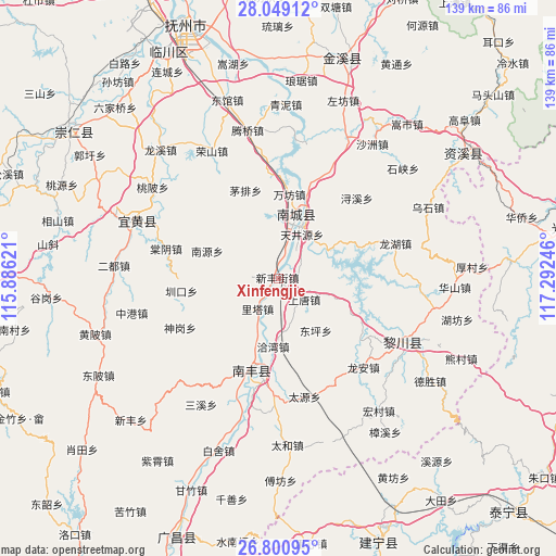
Xinfengjie GPS coordinates[2]
27° 25' 36.48" North, 116° 35' 21.588" East
| Map corner | latitude | longitude |
|---|---|---|
| Upper-left | 28.04912°, | 115.88621° |
| Center: | 27.4268°, | 116.58933° |
| Lower-right: | 26.80095°, | 117.29246° |
| Map W x H: | 138.8×138.8 km | = 86.2×86.2mi |
| max Lat: | 53.31946° ⇑76.9% North |
| Xinfengjie: | 27.4268° |
| min Lat: | ⇓23.1% South 18.22056° |
| min Long | Xinfengjie | max Long |
| 75.07348° | 116.58933° | 134.28917° |
| W 63.7%⇐ | ⇒36.3% E |
Elevation
Elevation of Xinfengjie is 95 m = 312 ft, and this is 389.8 m = 1279 ft below average elevation for this country.
| Max E: |
5622 m = 18445 ft | 60.6% |
| Avg. | 484.8 m = 1591 ft | |
| Xinfengjie | 95 m = 312 ft | |
Min E: |
-3 m = -10 ft | 39.4% |
See also: China elevation on elevation.city.
Geographical zone
Xinfengjie is located in North temperate zone (between Tropic of Cancer and the Arctic Circle). Distance of this Northern Tropic circle is 443.7 km =275.7 mi to South.| Distance of | km | miles | from Xinfengjie |
|---|---|---|---|
| North Pole | 6957.5 | 4323.2 | to North |
| Arctic Circle | 4351.6 | 2704 | to North |
| Tropic Cancer | 443.7 | 275.7 | to South |
| Equator | 3049.6 | 1894.9 | to South |


Nearby cities:
15 places around Xinfengjie: (largest is in red/bold)
• Dongping
15.9 km =9.9 mi,  144°
144°
• Hongmen
14 km =8.7 mi,  58°
58°
• Jianchang
15.4 km =9.6 mi,  18°
18°
• Laixi
24.1 km =15 mi,  182°
182°
• Lita
9.2 km =5.7 mi,  215°
215°
• Maopai
23.5 km =14.6 mi,  339°
339°
• Nanyuan
19.2 km =11.9 mi,  290°
290°
• Qiawan
17 km =10.6 mi, 184°
• Qincheng
24.5 km =15.2 mi,  193°
193°
• Shangtang
8.2 km =5.1 mi,  129°
129°
• Shishan
25.6 km =15.9 mi,  201°
201°
• Tianjingyuan
13 km =8.1 mi,  26°
26°
• Wanfang
21.2 km =13.2 mi,  7°
7°
• Zhenkou
24.5 km =15.2 mi,  262°
262°
• Zhuliang
4.8 km =3 mi, 13°
Sources, notices
• [Note1] Compared only with cities in China existing in our database
• [Src1] Map data: © OpenStreetMap contributors (CC-BY-SA)
• [Src2] Other city data from geonames.org with taken over terms of usage.
• [Src3] Geographical zone / Annual Mean Temperature by Robert A. Rohde @ Wikipedia
