Rongtang geodata
Rongtang (Jiangxi) is a seat of a fourth-order administrative division; located in China in Asia/Shanghai (GMT+8) time zone. In our database, there are 1268 cities with bigger population. Compared to other cities in China, 73.2% of cities are located further ↑North; 58.2% of cities are located further ←West and 79.8% of cities have higher elevation than Rongtang. Note1


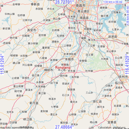
Rongtang GPS coordinates[2]
28° 6' 31.032" North, 115° 42' 54.576" East
| Map corner | latitude | longitude |
|---|---|---|
| Upper-left | 28.72701°, | 115.01204° |
| Center: | 28.10862°, | 115.71516° |
| Lower-right: | 27.48664°, | 116.41829° |
| Map W x H: | 137.9×137.9 km | = 85.7×85.7mi |
| max Lat: | 53.31946° ⇑73.2% North |
| Rongtang: | 28.10862° |
| min Lat: | ⇓26.8% South 18.22056° |
| min Long | Rongtang | max Long |
| 75.07348° | 115.71516° | 134.28917° |
| W 58.2%⇐ | ⇒41.8% E |
Elevation
Elevation of Rongtang is 27 m = 89 ft, and this is 457.8 m = 1502 ft below average elevation for this country.
| Max E: |
5622 m = 18445 ft | 79.8% |
| Avg. | 484.8 m = 1591 ft | |
| Rongtang | 27 m = 89 ft | |
Min E: |
-3 m = -10 ft | 20.2% |
See also: China elevation on elevation.city.
Geographical zone
Rongtang is located in North temperate zone (between Tropic of Cancer and the Arctic Circle). Distance of this Northern Tropic circle is 519.5 km =322.8 mi to South.| Distance of | km | miles | from Rongtang |
|---|---|---|---|
| North Pole | 6881.7 | 4276.1 | to North |
| Arctic Circle | 4275.8 | 2656.9 | to North |
| Tropic Cancer | 519.5 | 322.8 | to South |
| Equator | 3125.4 | 1942 | to South |


Nearby cities:
15 places around Rongtang: (largest is in red/bold)
• Daqiao
14.5 km =9 mi,  245°
245°
• Hehu
20 km =12.4 mi,  177°
177°
• Jianguang
11.6 km =7.2 mi,  35°
35°
• Licun
12.7 km =7.9 mi,  187°
187°
• Luoshi
17.1 km =10.6 mi,  139°
139°
• Meilin
19.9 km =12.4 mi,  343°
343°
• Qiaodong
11.7 km =7.3 mi,  118°
118°
• Quangang
12.8 km =8 mi,  294°
294°
• Qujiang
17.1 km =10.6 mi,  25°
25°
• Shangtang
20.5 km =12.7 mi,  4°
4°
• Shangzhuang
16.6 km =10.3 mi,  348°
348°
• Shitan
12.3 km =7.6 mi,  78°
78°
• Sundu
6 km =3.7 mi,  54°
54°
• Tuochuan
7.3 km =4.5 mi,  312°
312°
• Zhangxiang
19.9 km =12.4 mi, 76°
Sources, notices
• [Note1] Compared only with cities in China existing in our database
• [Src1] Map data: © OpenStreetMap contributors (CC-BY-SA)
• [Src2] Other city data from geonames.org with taken over terms of usage.
• [Src3] Geographical zone / Annual Mean Temperature by Robert A. Rohde @ Wikipedia
