Xushangqiao geodata
Xushangqiao (Jiangxi) is a seat of a fourth-order administrative division; located in China in Asia/Shanghai (GMT+8) time zone. In our database, there are 1268 cities with bigger population. Compared to other cities in China, 72.1% of cities are located further ↑North; 63.3% of cities are located further ←West and 71% of cities have higher elevation than Xushangqiao. Note1


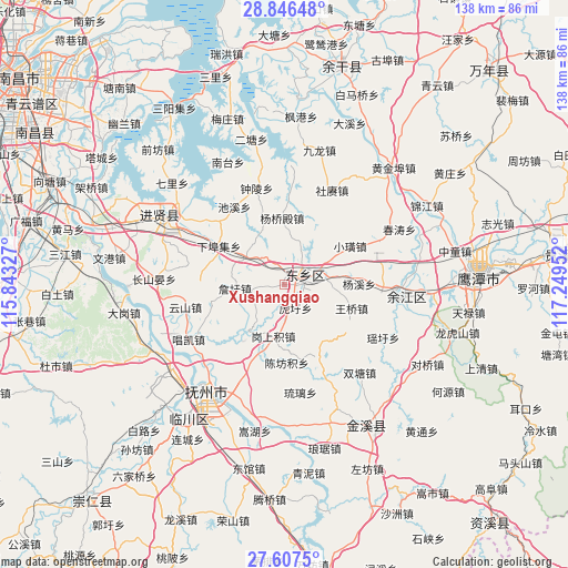
Xushangqiao GPS coordinates[2]
28° 13' 43.644" North, 116° 32' 47.004" East
| Map corner | latitude | longitude |
|---|---|---|
| Upper-left | 28.84648°, | 115.84327° |
| Center: | 28.22879°, | 116.54639° |
| Lower-right: | 27.6075°, | 117.24952° |
| Map W x H: | 137.8×137.8 km | = 85.6×85.6mi |
| max Lat: | 53.31946° ⇑72.1% North |
| Xushangqiao: | 28.22879° |
| min Lat: | ⇓27.9% South 18.22056° |
| min Long | Xushangqiao | max Long |
| 75.07348° | 116.54639° | 134.28917° |
| W 63.3%⇐ | ⇒36.7% E |
Elevation
Elevation of Xushangqiao is 48 m = 157 ft, and this is 436.8 m = 1433 ft below average elevation for this country.
| Max E: |
5622 m = 18445 ft | 71% |
| Avg. | 484.8 m = 1591 ft | |
| Xushangqiao | 48 m = 157 ft | |
Min E: |
-3 m = -10 ft | 29% |
See also: China elevation on elevation.city.
Geographical zone
Xushangqiao is located in North temperate zone (between Tropic of Cancer and the Arctic Circle). Distance of this Northern Tropic circle is 532.8 km =331.1 mi to South.| Distance of | km | miles | from Xushangqiao |
|---|---|---|---|
| North Pole | 6868.3 | 4267.8 | to North |
| Arctic Circle | 4262.4 | 2648.5 | to North |
| Tropic Cancer | 532.8 | 331.1 | to South |
| Equator | 3138.7 | 1950.3 | to South |


Nearby cities:
15 places around Xushangqiao: (largest is in red/bold)
• Chenfangji
18.8 km =11.7 mi,  177°
177°
• Dengdun
19.2 km =11.9 mi,  8°
8°
• Dengjiaxiang
3 km =1.9 mi,  29°
29°
• Gangshangji
12.9 km =8 mi,  191°
191°
• Huxu
6.4 km =4 mi,  154°
154°
• Lixu
19.7 km =12.2 mi, 154°
• Maxu
13.1 km =8.1 mi,  216°
216°
• Taiyang
19.7 km =12.2 mi,  199°
199°
• Wangqiao
17.4 km =10.8 mi,  109°
109°
• Xiabuji
18.4 km =11.4 mi,  298°
298°
• Xiaohuang
18.5 km =11.5 mi,  59°
59°
• Yangqiaodian
15.9 km =9.9 mi,  358°
358°
• Yangxi
18.2 km =11.3 mi,  89°
89°
• Yaqian
11.4 km =7.1 mi,  306°
306°
• Zhanxu
12.1 km =7.5 mi,  265°
265°
Sources, notices
• [Note1] Compared only with cities in China existing in our database
• [Src1] Map data: © OpenStreetMap contributors (CC-BY-SA)
• [Src2] Other city data from geonames.org with taken over terms of usage.
• [Src3] Geographical zone / Annual Mean Temperature by Robert A. Rohde @ Wikipedia
