Xingsha geodata
Xingsha (Hunan) is a seat of a third-order administrative division; located in China in Asia/Shanghai (GMT+8) time zone. In our database, there are 1268 cities with bigger population. Compared to other cities in China, 72% of cities are located further ↑North; 57% of cities are located further →East and 65.8% of cities have higher elevation than Xingsha. Note1


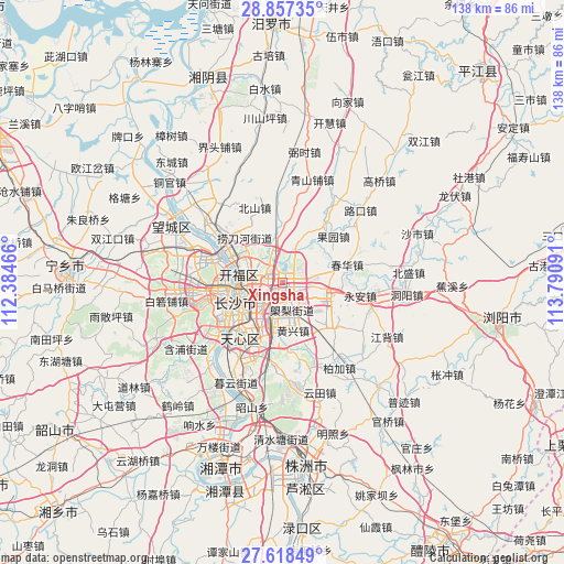
Xingsha GPS coordinates[2]
28° 14' 22.992" North, 113° 5' 16.008" East
| Map corner | latitude | longitude |
|---|---|---|
| Upper-left | 28.85735°, | 112.38466° |
| Center: | 28.23972°, | 113.08778° |
| Lower-right: | 27.61849°, | 113.79091° |
| Map W x H: | 137.7×137.7 km | = 85.6×85.6mi |
| max Lat: | 53.31946° ⇑72% North |
| Xingsha: | 28.23972° |
| min Lat: | ⇓28% South 18.22056° |
| min Long | Xingsha | max Long |
| 75.07348° | 113.08778° | 134.28917° |
| W 43%⇐ | ⇒57% E |
Elevation
Elevation of Xingsha is 69 m = 226 ft, and this is 415.8 m = 1364 ft below average elevation for this country.
| Max E: |
5622 m = 18445 ft | 65.8% |
| Avg. | 484.8 m = 1591 ft | |
| Xingsha | 69 m = 226 ft | |
Min E: |
-3 m = -10 ft | 34.2% |
See also: China elevation on elevation.city.
Geographical zone
Xingsha is located in North temperate zone (between Tropic of Cancer and the Arctic Circle). Distance of this Northern Tropic circle is 534 km =331.8 mi to South.| Distance of | km | miles | from Xingsha |
|---|---|---|---|
| North Pole | 6867.1 | 4267 | to North |
| Arctic Circle | 4261.2 | 2647.8 | to North |
| Tropic Cancer | 534 | 331.8 | to South |
| Equator | 3140 | 1951.1 | to South |


Nearby cities:
15 places around Xingsha: (largest is in red/bold)
• Bairuopu
28.5 km =17.7 mi,  261°
261°
• Beishan
20.2 km =12.6 mi,  333°
333°
• Changsha
12.3 km =7.6 mi,  248°
248°
• Chating
32.7 km =20.3 mi, 331°
• Datuo
24.2 km =15 mi,  214°
214°
• Dongjing
17.9 km =11.1 mi,  198°
198°
• Dongtundu
8.3 km =5.2 mi,  221°
221°
• Furong Beilu
10.5 km =6.5 mi,  268°
268°
• Gaotangling
30.1 km =18.7 mi,  298°
298°
• Guitang
11.9 km =7.4 mi, 201°
• Muyun
25.4 km =15.8 mi, 205°
• Pingtang
24.2 km =15 mi, 224°
• Qiaoyi
25.7 km =16 mi,  320°
320°
• Qingyuan
16.2 km =10.1 mi, 212°
• Wangyue
16.7 km =10.4 mi, 268°
Sources, notices
• [Note1] Compared only with cities in China existing in our database
• [Src1] Map data: © OpenStreetMap contributors (CC-BY-SA)
• [Src2] Other city data from geonames.org with taken over terms of usage.
• [Src3] Geographical zone / Annual Mean Temperature by Robert A. Rohde @ Wikipedia
