Huilongan geodata
Huilongan (Hunan) is a seat of a fourth-order administrative division; located in China in Asia/Shanghai (GMT+8) time zone. In our database, there are 1268 cities with bigger population. Compared to other cities in China, 66.4% of cities are located further ↑North; 70.4% of cities are located further →East and 67% of cities have lower elevation than Huilongan. Note1


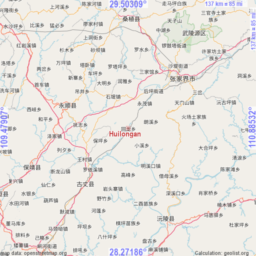
Huilongan GPS coordinates[2]
28° 53' 21.48" North, 110° 10' 55.884" East
| Map corner | latitude | longitude |
|---|---|---|
| Upper-left | 29.50309°, | 109.47907° |
| Center: | 28.8893°, | 110.18219° |
| Lower-right: | 28.27186°, | 110.88532° |
| Map W x H: | 136.9×136.9 km | = 85.1×85.1mi |
| max Lat: | 53.31946° ⇑66.4% North |
| Huilongan: | 28.8893° |
| min Lat: | ⇓33.6% South 18.22056° |
| min Long | Huilongan | max Long |
| 75.07348° | 110.18219° | 134.28917° |
| W 29.6%⇐ | ⇒70.4% E |
Elevation
Elevation of Huilongan is 359 m = 1178 ft, and this is 125.8 m = 413 ft below average elevation for this country.
| Max E: |
5622 m = 18445 ft | 33% |
| Avg. | 484.8 m = 1591 ft | |
| Huilongan | 359 m = 1178 ft | |
Min E: |
-3 m = -10 ft | 67% |
See also: China elevation on elevation.city.
Geographical zone
Huilongan is located in North temperate zone (between Tropic of Cancer and the Arctic Circle). Distance of this Northern Tropic circle is 606.3 km =376.7 mi to South.| Distance of | km | miles | from Huilongan |
|---|---|---|---|
| North Pole | 6794.9 | 4222.2 | to North |
| Arctic Circle | 4189 | 2602.9 | to North |
| Tropic Cancer | 606.3 | 376.7 | to South |
| Equator | 3212.2 | 1996 | to South |


Nearby cities:
15 places around Huilongan: (largest is in red/bold)
• Baoping
16.8 km =10.4 mi,  243°
243°
• Chexi
25.2 km =15.7 mi,  356°
356°
• Daming
27.4 km =17 mi,  332°
332°
• Fuzhiping
25.2 km =15.7 mi,  271°
271°
• Gaofeng
24.8 km =15.4 mi,  179°
179°
• Houping
23.9 km =14.9 mi,  34°
34°
• Langxi
12.9 km =8 mi,  73°
73°
• Macha
21.6 km =13.4 mi,  322°
322°
• Mingxikou
24.8 km =15.4 mi,  148°
148°
• Qingping
16.1 km =10 mi,  16°
16°
• Shidixi
18.7 km =11.6 mi,  335°
335°
• Shiziqiao
14.9 km =9.3 mi,  312°
312°
• Siduping
24.6 km =15.3 mi,  79°
79°
• Ximi
17.3 km =10.7 mi,  278°
278°
• Yongmao
16.6 km =10.3 mi, 32°
Sources, notices
• [Note1] Compared only with cities in China existing in our database
• [Src1] Map data: © OpenStreetMap contributors (CC-BY-SA)
• [Src2] Other city data from geonames.org with taken over terms of usage.
• [Src3] Geographical zone / Annual Mean Temperature by Robert A. Rohde @ Wikipedia
