Gaoqiao geodata
Gaoqiao (Shaanxi) is a seat of a fourth-order administrative division; located in China in Asia/Shanghai (GMT+8) time zone. In our database, there are 1268 cities with bigger population. Compared to other cities in China, 71.3% of cities are located further ↓South; 77.6% of cities are located further →East and 68.7% of cities have lower elevation than Gaoqiao. Note1


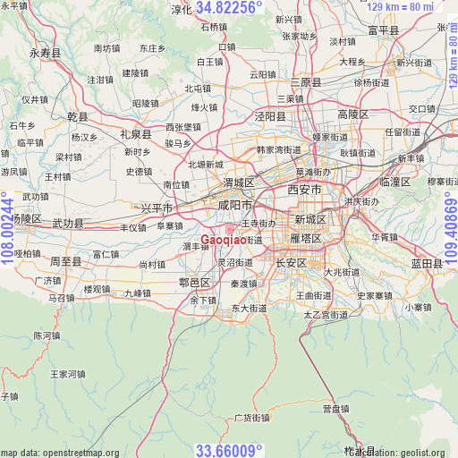
Gaoqiao GPS coordinates[2]
34° 14' 35.988" North, 108° 42' 20.016" East
| Map corner | latitude | longitude |
|---|---|---|
| Upper-left | 34.82256°, | 108.00244° |
| Center: | 34.24333°, | 108.70556° |
| Lower-right: | 33.66009°, | 109.40869° |
| Map W x H: | 129.3×129.3 km | = 80.3×80.3mi |
| max Lat: | 53.31946° ⇑28.7% North |
| Gaoqiao: | 34.24333° |
| min Lat: | ⇓71.3% South 18.22056° |
| min Long | Gaoqiao | max Long |
| 75.07348° | 108.70556° | 134.28917° |
| W 22.4%⇐ | ⇒77.6% E |
Elevation
Elevation of Gaoqiao is 388 m = 1273 ft, and this is 96.8 m = 318 ft below average elevation for this country.
| Max E: |
5622 m = 18445 ft | 31.3% |
| Avg. | 484.8 m = 1591 ft | |
| Gaoqiao | 388 m = 1273 ft | |
Min E: |
-3 m = -10 ft | 68.7% |
See also: China elevation on elevation.city.
Geographical zone
Gaoqiao is located in North temperate zone (between Tropic of Cancer and the Arctic Circle). Distance of this Northern Tropic circle is 1201.6 km =746.6 mi to South.| Distance of | km | miles | from Gaoqiao |
|---|---|---|---|
| North Pole | 6199.6 | 3852.3 | to North |
| Arctic Circle | 3593.7 | 2233 | to North |
| Tropic Cancer | 1201.6 | 746.6 | to South |
| Equator | 3807.5 | 2365.9 | to South |


Nearby cities:
15 places around Gaoqiao: (largest is in red/bold)
• Cangyou
10.1 km =6.3 mi,  207°
207°
• Chenyangzhai
8.5 km =5.3 mi,  0°
0°
• Dawang
6.7 km =4.2 mi,  228°
228°
• Diaotai
5 km =3.1 mi,  339°
339°
• Doumen
5.2 km =3.2 mi,  123°
123°
• Fengdong
10.3 km =6.4 mi,  28°
28°
• Gudu
11.4 km =7.1 mi,  354°
354°
• Mawang
4.4 km =2.7 mi,  171°
171°
• Qindu
11 km =6.8 mi, 1°
• Tianfu
10.5 km =6.5 mi,  282°
282°
• Wangsi
8.2 km =5.1 mi,  84°
84°
• Weibin
9.8 km =6.1 mi,  325°
325°
• Weicheng
9.8 km =6.1 mi,  6°
6°
• Weifeng
10 km =6.2 mi,  237°
237°
• Xianyang
10.5 km =6.5 mi,  358°
358°
Sources, notices
• [Note1] Compared only with cities in China existing in our database
• [Src1] Map data: © OpenStreetMap contributors (CC-BY-SA)
• [Src2] Other city data from geonames.org with taken over terms of usage.
• [Src3] Geographical zone / Annual Mean Temperature by Robert A. Rohde @ Wikipedia
