Songjianghe geodata
Songjianghe (Jilin) is a seat of a fourth-order administrative division; located in China in Asia/Shanghai (GMT+8) time zone. With population of 67,672 people, there are 634 cities with bigger population in this country. Compared to other cities in China, 91.1% of cities are located further ↓South; 97.5% of cities are located further ←West and 80.9% of cities have lower elevation than Songjianghe. Note1


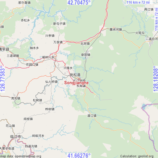
Songjianghe GPS coordinates[2]
42° 11' 9.24" North, 127° 28' 44.22" East
| Map corner | latitude | longitude |
|---|---|---|
| Upper-left | 42.70475°, | 126.77583° |
| Center: | 42.1859°, | 127.47895° |
| Lower-right: | 41.66276°, | 128.18208° |
| Map W x H: | 115.9×115.9 km | = 72×72mi |
| max Lat: | 53.31946° ⇑8.9% North |
| Songjianghe: | 42.1859° |
| min Lat: | ⇓91.1% South 18.22056° |
| min Long | Songjianghe | max Long |
| 75.07348° | 127.47895° | 134.28917° |
| W 97.5%⇐ | ⇒2.5% E |
Elevation
Elevation of Songjianghe is 737 m = 2418 ft, and this is 252.2 m = 827 ft above average elevation for this country.
| Max E: |
5622 m = 18445 ft | 19.1% |
| Songjianghe | 737 m 2418 ft | |
| Avg. | 484.8 m = 1591 ft | |
Min E: |
-3 m = -10 ft | 80.9% |
See also: Songjianghe elevation on elevation.city.
Geographical zone
Songjianghe is located in North temperate zone (between Tropic of Cancer and the Arctic Circle). Distance of this Northern Tropic circle is 2084.7 km =1295.4 mi to South.| Distance of | km | miles | from Songjianghe |
|---|---|---|---|
| North Pole | 5316.4 | 3303.5 | to North |
| Arctic Circle | 2710.5 | 1684.2 | to North |
| Tropic Cancer | 2084.7 | 1295.4 | to South |
| Equator | 4690.6 | 2914.6 | to South |


Nearby cities:
15 places around Songjianghe: (largest is in red/bold)
• Beigang
26.4 km =16.4 mi,  9°
9°
• Donggang
2.8 km =1.7 mi,  168°
168°
• Fusong
23 km =14.3 mi,  312°
312°
• Huashu
30.6 km =19 mi,  224°
224°
• Huayuankou
36 km =22.4 mi,  288°
288°
• Manjiang
28.1 km =17.5 mi,  160°
160°
• Quanyang
19.2 km =11.9 mi,  16°
16°
• Songjiang
11 km =6.8 mi, 293°
• Songjiao
21.1 km =13.1 mi, 308°
• Songshu
34.5 km =21.4 mi,  242°
242°
• Wanliang
31.5 km =19.6 mi,  330°
330°
• Xianrenqiao
20.4 km =12.7 mi,  265°
265°
• Xinglong
11.4 km =7.1 mi,  317°
317°
• Xinxigang
16.9 km =10.5 mi, 216°
• Yushuchuan
27.7 km =17.2 mi, 305°
Sources, notices
• [Note1] Compared only with cities in China existing in our database
• [Src1] Map data: © OpenStreetMap contributors (CC-BY-SA)
• [Src2] Other city data from geonames.org with taken over terms of usage.
• [Src3] Geographical zone / Annual Mean Temperature by Robert A. Rohde @ Wikipedia
