Kuanbang geodata
Kuanbang (Liaoning) is a seat of a fourth-order administrative division; located in China in Asia/Shanghai (GMT+8) time zone. In our database, there are 1268 cities with bigger population. Compared to other cities in China, 88.1% of cities are located further ↓South; 82.7% of cities are located further ←West and 64.5% of cities have higher elevation than Kuanbang. Note1


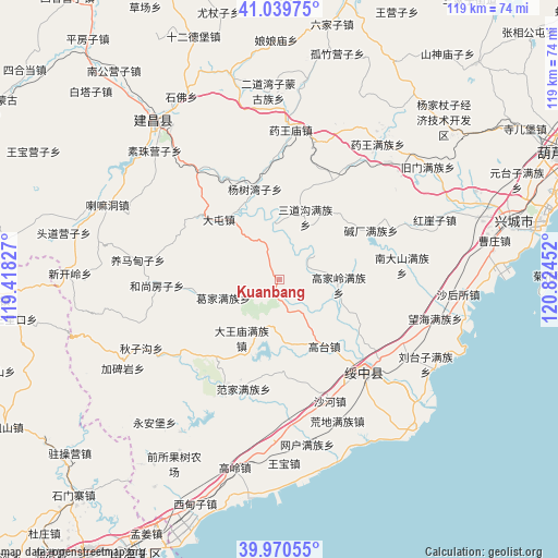
Kuanbang GPS coordinates[2]
40° 30' 26.208" North, 120° 7' 17.004" East
| Map corner | latitude | longitude |
|---|---|---|
| Upper-left | 41.03975°, | 119.41827° |
| Center: | 40.50728°, | 120.12139° |
| Lower-right: | 39.97055°, | 120.82452° |
| Map W x H: | 118.9×118.9 km | = 73.9×73.9mi |
| max Lat: | 53.31946° ⇑11.9% North |
| Kuanbang: | 40.50728° |
| min Lat: | ⇓88.1% South 18.22056° |
| min Long | Kuanbang | max Long |
| 75.07348° | 120.12139° | 134.28917° |
| W 82.7%⇐ | ⇒17.3% E |
Elevation
Elevation of Kuanbang is 75 m = 246 ft, and this is 409.8 m = 1344 ft below average elevation for this country.
| Max E: |
5622 m = 18445 ft | 64.5% |
| Avg. | 484.8 m = 1591 ft | |
| Kuanbang | 75 m = 246 ft | |
Min E: |
-3 m = -10 ft | 35.5% |
See also: China elevation on elevation.city.
Geographical zone
Kuanbang is located in North temperate zone (between Tropic of Cancer and the Arctic Circle). Distance of this Northern Tropic circle is 1898.1 km =1179.4 mi to South.| Distance of | km | miles | from Kuanbang |
|---|---|---|---|
| North Pole | 5503.1 | 3419.5 | to North |
| Arctic Circle | 2897.2 | 1800.2 | to North |
| Tropic Cancer | 1898.1 | 1179.4 | to South |
| Equator | 4504 | 2798.7 | to South |


Nearby cities:
15 places around Kuanbang: (largest is in red/bold)
• Chengjiao
26.7 km =16.6 mi,  136°
136°
• Dongshangen
33 km =20.5 mi,  243°
243°
• Fanjia
24.6 km =15.3 mi,  198°
198°
• Gaodianzi
13.9 km =8.6 mi,  173°
173°
• Gaotai
17.1 km =10.6 mi,  146°
146°
• Guangyudian
12.8 km =8 mi,  251°
251°
• Guta
35.2 km =21.9 mi,  183°
183°
• Huangdi
32.7 km =20.3 mi,  157°
157°
• Mingshui
25.6 km =15.9 mi,  230°
230°
• Piaojia
35.6 km =22.1 mi, 170°
• Shahe
28 km =17.4 mi, 157°
• Suizhong
26.9 km =16.7 mi, 137°
• Tashantun
36.4 km =22.6 mi, 140°
• Xipingpo
7.8 km =4.8 mi, 147°
• 城郊
26.7 km =16.6 mi, 136°
Sources, notices
• [Note1] Compared only with cities in China existing in our database
• [Src1] Map data: © OpenStreetMap contributors (CC-BY-SA)
• [Src2] Other city data from geonames.org with taken over terms of usage.
• [Src3] Geographical zone / Annual Mean Temperature by Robert A. Rohde @ Wikipedia
