Inder geodata
Inder (Inner Mongolia) is a seat of a third-order administrative division; located in China in Asia/Shanghai (GMT+8) time zone. In our database, there are 1268 cities with bigger population. Compared to other cities in China, 96.3% of cities are located further ↓South; 92.6% of cities are located further ←West and 52.1% of cities have lower elevation than Inder. Note1


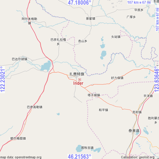
Inder GPS coordinates[2]
46° 42' 0" North, 122° 55' 59.988" East
| Map corner | latitude | longitude |
|---|---|---|
| Upper-left | 47.18006°, | 122.23021° |
| Center: | 46.7°, | 122.93333° |
| Lower-right: | 46.21563°, | 123.63646° |
| Map W x H: | 107.2×107.2 km | = 66.6×66.6mi |
| max Lat: | 53.31946° ⇑3.7% North |
| Inder: | 46.7° |
| min Lat: | ⇓96.3% South 18.22056° |
| min Long | Inder | max Long |
| 75.07348° | 122.93333° | 134.28917° |
| W 92.6%⇐ | ⇒7.4% E |
Elevation
Elevation of Inder is 182 m = 597 ft, and this is 302.8 m = 993 ft below average elevation for this country.
| Max E: |
5622 m = 18445 ft | 47.9% |
| Avg. | 484.8 m = 1591 ft | |
| Inder | 182 m = 597 ft | |
Min E: |
-3 m = -10 ft | 52.1% |
See also: China elevation on elevation.city.
Geographical zone
Inder is located in North temperate zone (between Tropic of Cancer and the Arctic Circle). Distance of this North polar circle is 2208.6 km =1372.4 mi to North.| Distance of | km | miles | from Inder |
|---|---|---|---|
| North Pole | 4814.5 | 2991.6 | to North |
| Arctic Circle | 2208.6 | 1372.4 | to North |
| Tropic Cancer | 2586.6 | 1607.2 | to South |
| Equator | 5192.6 | 3226.5 | to South |


Nearby cities:
15 places around Inder: (largest is in red/bold)
• Badai
18.8 km =11.7 mi,  109°
109°
• Bayan Gol
37.4 km =23.2 mi,  246°
246°
• Haolibao
25.3 km =15.7 mi,  87°
87°
• Heping
25.9 km =16.1 mi,  141°
141°
• Hongsheng
50.1 km =31.1 mi, 144°
• Jingxing
41.8 km =26 mi,  10°
10°
• Keli
44.4 km =27.6 mi,  119°
119°
• Nuwen Muren
51.2 km =31.8 mi,  83°
83°
• Pingyang
47.5 km =29.5 mi,  103°
103°
• Siliwu
28.9 km =18 mi, 119°
• Tailai
50.4 km =31.3 mi,  133°
133°
• Tazicheng
13.9 km =8.6 mi, 137°
• Touzhan
37.8 km =23.5 mi,  40°
40°
• Tumuji
47.7 km =29.6 mi,  176°
176°
• Yongfa
51.2 km =31.8 mi, 9°
Sources, notices
• [Note1] Compared only with cities in China existing in our database
• [Src1] Map data: © OpenStreetMap contributors (CC-BY-SA)
• [Src2] Other city data from geonames.org with taken over terms of usage.
• [Src3] Geographical zone / Annual Mean Temperature by Robert A. Rohde @ Wikipedia
