Huadian geodata
Huadian (Jilin) is a populated place; located in China in Asia/Shanghai (GMT+8) time zone. With population of 139,047 people, there are 317 cities with bigger population in this country. Compared to other cities in China, 92% of cities are located further ↓South; 96.3% of cities are located further ←West and 60.8% of cities have lower elevation than Huadian. Note1


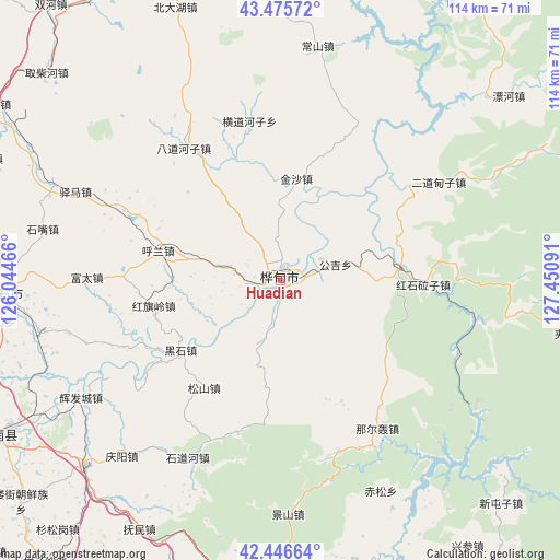
Huadian GPS coordinates[2]
42° 57' 47.988" North, 126° 44' 52.008" East
| Map corner | latitude | longitude |
|---|---|---|
| Upper-left | 43.47572°, | 126.04466° |
| Center: | 42.96333°, | 126.74778° |
| Lower-right: | 42.44664°, | 127.45091° |
| Map W x H: | 114.4×114.4 km | = 71.1×71.1mi |
| max Lat: | 53.31946° ⇑8% North |
| Huadian: | 42.96333° |
| min Lat: | ⇓92% South 18.22056° |
| min Long | Huadian | max Long |
| 75.07348° | 126.74778° | 134.28917° |
| W 96.3%⇐ | ⇒3.7% E |
Elevation
Elevation of Huadian is 268 m = 879 ft, and this is 216.8 m = 711 ft below average elevation for this country.
| Max E: |
5622 m = 18445 ft | 39.2% |
| Avg. | 484.8 m = 1591 ft | |
| Huadian | 268 m = 879 ft | |
Min E: |
-3 m = -10 ft | 60.8% |
See also: Huadian elevation on elevation.city.
Geographical zone
Huadian is located in North temperate zone (between Tropic of Cancer and the Arctic Circle). Distance of this Northern Tropic circle is 2171.2 km =1349.1 mi to South.| Distance of | km | miles | from Huadian |
|---|---|---|---|
| North Pole | 5230 | 3249.8 | to North |
| Arctic Circle | 2624.1 | 1630.5 | to North |
| Tropic Cancer | 2171.2 | 1349.1 | to South |
| Equator | 4777.1 | 2968.4 | to South |


Nearby cities:
15 places around Huadian: (largest is in red/bold)
• Baishan
47.2 km =29.3 mi,  122°
122°
• Chisong
47.5 km =29.5 mi,  153°
153°
• Dujia
36.7 km =22.8 mi,  161°
161°
• Erdaocha
61.2 km =38 mi,  100°
100°
• Erdaodianzi
37.7 km =23.4 mi,  58°
58°
• Gongji
11.8 km =7.3 mi,  72°
72°
• Hongshi
28.8 km =17.9 mi,  91°
91°
• Huangni
63.7 km =39.6 mi,  135°
135°
• Huinan
54.9 km =34.1 mi,  226°
226°
• Jingyu
65.8 km =40.9 mi,  176°
176°
• Jiujianfang
8.7 km =5.4 mi, 89°
• Laojinchang
49.7 km =30.9 mi, 97°
• Na’erhong
36.2 km =22.5 mi, 146°
• Panshi
56.3 km =35 mi,  267°
267°
• Yushu
58.3 km =36.2 mi, 144°
Sources, notices
• [Note1] Compared only with cities in China existing in our database
• [Src1] Map data: © OpenStreetMap contributors (CC-BY-SA)
• [Src2] Other city data from geonames.org with taken over terms of usage.
• [Src3] Geographical zone / Annual Mean Temperature by Robert A. Rohde @ Wikipedia
