Panshi geodata
Panshi (Jilin) is a populated place; located in China in Asia/Shanghai (GMT+8) time zone. With population of 80,200 people, there are 532 cities with bigger population in this country. Compared to other cities in China, 91.9% of cities are located further ↓South; 95.6% of cities are located further ←West and 64.9% of cities have lower elevation than Panshi. Note1


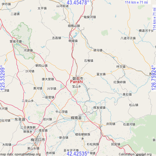
Panshi GPS coordinates[2]
42° 56' 31.992" North, 126° 3' 21.996" East
| Map corner | latitude | longitude |
|---|---|---|
| Upper-left | 43.45478°, | 125.35299° |
| Center: | 42.94222°, | 126.05611° |
| Lower-right: | 42.42535°, | 126.75924° |
| Map W x H: | 114.5×114.5 km | = 71.1×71.1mi |
| max Lat: | 53.31946° ⇑8.1% North |
| Panshi: | 42.94222° |
| min Lat: | ⇓91.9% South 18.22056° |
| min Long | Panshi | max Long |
| 75.07348° | 126.05611° | 134.28917° |
| W 95.6%⇐ | ⇒4.4% E |
Elevation
Elevation of Panshi is 323 m = 1060 ft, and this is 161.8 m = 531 ft below average elevation for this country.
| Max E: |
5622 m = 18445 ft | 35.1% |
| Avg. | 484.8 m = 1591 ft | |
| Panshi | 323 m = 1060 ft | |
Min E: |
-3 m = -10 ft | 64.9% |
See also: Panshi elevation on elevation.city.
Geographical zone
Panshi is located in North temperate zone (between Tropic of Cancer and the Arctic Circle). Distance of this Northern Tropic circle is 2168.8 km =1347.6 mi to South.| Distance of | km | miles | from Panshi |
|---|---|---|---|
| North Pole | 5232.3 | 3251.2 | to North |
| Arctic Circle | 2626.4 | 1632 | to North |
| Tropic Cancer | 2168.8 | 1347.6 | to South |
| Equator | 4774.7 | 2966.9 | to South |


Nearby cities:
15 places around Panshi: (largest is in red/bold)
• Chaoyang
31.2 km =19.4 mi,  184°
184°
• Dongfeng
55.7 km =34.6 mi,  232°
232°
• Dujia
75.6 km =47 mi,  115°
115°
• Gongji
67.8 km =42.1 mi,  85°
85°
• Huadian
56.3 km =35 mi, 87°
• Huinan
39.3 km =24.4 mi,  154°
154°
• Jiujianfang
65.1 km =40.5 mi, 87°
• Kouqian
84 km =52.2 mi,  22°
22°
• Liaoyuan
75.1 km =46.7 mi,  266°
266°
• Liuhe
82.9 km =51.5 mi,  199°
199°
• Meihekou
55.6 km =34.5 mi,  213°
213°
• Na’erhong
81.2 km =50.5 mi,  110°
110°
• Shuangyang
71.7 km =44.6 mi,  334°
334°
• Yantongshan
39.1 km =24.3 mi,  354°
354°
• Yitong
74.9 km =46.5 mi,  304°
304°
Sources, notices
• [Note1] Compared only with cities in China existing in our database
• [Src1] Map data: © OpenStreetMap contributors (CC-BY-SA)
• [Src2] Other city data from geonames.org with taken over terms of usage.
• [Src3] Geographical zone / Annual Mean Temperature by Robert A. Rohde @ Wikipedia
