Haicheng geodata
Haicheng (Liaoning) is a seat of a third-order administrative division; located in China in Asia/Shanghai (GMT+8) time zone. With population of 191,651 people, there are 237 cities with bigger population in this country. Compared to other cities in China, 88.9% of cities are located further ↓South; 92.4% of cities are located further ←West and 76.7% of cities have higher elevation than Haicheng. Note1


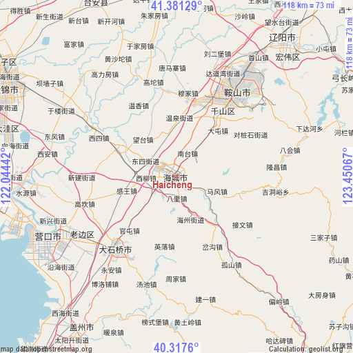
Haicheng GPS coordinates[2]
40° 51' 5.688" North, 122° 44' 51.144" East
| Map corner | latitude | longitude |
|---|---|---|
| Upper-left | 41.38129°, | 122.04442° |
| Center: | 40.85158°, | 122.74754° |
| Lower-right: | 40.3176°, | 123.45067° |
| Map W x H: | 118.3×118.3 km | = 73.5×73.5mi |
| max Lat: | 53.31946° ⇑11.1% North |
| Haicheng: | 40.85158° |
| min Lat: | ⇓88.9% South 18.22056° |
| min Long | Haicheng | max Long |
| 75.07348° | 122.74754° | 134.28917° |
| W 92.4%⇐ | ⇒7.6% E |
Elevation
Elevation of Haicheng is 33 m = 108 ft, and this is 451.8 m = 1482 ft below average elevation for this country.
| Max E: |
5622 m = 18445 ft | 76.7% |
| Avg. | 484.8 m = 1591 ft | |
| Haicheng | 33 m = 108 ft | |
Min E: |
-3 m = -10 ft | 23.3% |
See also: Haicheng elevation on elevation.city.
Geographical zone
Haicheng is located in North temperate zone (between Tropic of Cancer and the Arctic Circle). Distance of this Northern Tropic circle is 1936.4 km =1203.2 mi to South.| Distance of | km | miles | from Haicheng |
|---|---|---|---|
| North Pole | 5464.8 | 3395.7 | to North |
| Arctic Circle | 2858.9 | 1776.4 | to North |
| Tropic Cancer | 1936.4 | 1203.2 | to South |
| Equator | 4542.3 | 2822.5 | to South |


Nearby cities:
15 places around Haicheng: (largest is in red/bold)
• Bali
7 km =4.3 mi,  175°
175°
• Dongsi
11.1 km =6.9 mi,  297°
297°
• Ganquan
15.4 km =9.6 mi,  35°
35°
• Gengzhuang
15.3 km =9.5 mi,  345°
345°
• Haizhou
0.6 km =0.4 mi,  237°
237°
• Mafeng
14.4 km =8.9 mi,  109°
109°
• Maoqi
7.9 km =4.9 mi,  214°
214°
• Nantai
9.4 km =5.8 mi,  30°
30°
• Pailou
14.4 km =8.9 mi,  156°
156°
• Qianliu
9.6 km =6 mi,  263°
263°
• Wangshi
5.9 km =3.7 mi,  80°
80°
• Xiangtang
2.7 km =1.7 mi,  139°
139°
• Xiliu
10.4 km =6.5 mi,  268°
268°
• Xinghai
2 km =1.2 mi, 304°
• Zhongxiao
16.5 km =10.3 mi,  284°
284°
Sources, notices
• [Note1] Compared only with cities in China existing in our database
• [Src1] Map data: © OpenStreetMap contributors (CC-BY-SA)
• [Src2] Other city data from geonames.org with taken over terms of usage.
• [Src3] Geographical zone / Annual Mean Temperature by Robert A. Rohde @ Wikipedia
