Dongxiaokou geodata
Dongxiaokou (Beijing) is a seat of a fourth-order administrative division; located in China in Asia/Shanghai (GMT+8) time zone. In our database, there are 1268 cities with bigger population. Compared to other cities in China, 86.6% of cities are located further ↓South; 62.4% of cities are located further ←West and 74.8% of cities have higher elevation than Dongxiaokou. Note1


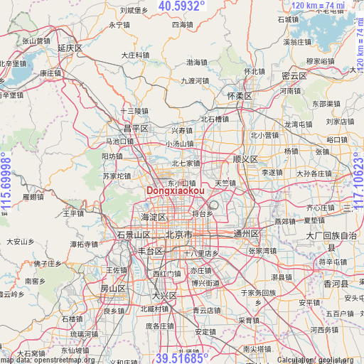
Dongxiaokou GPS coordinates[2]
40° 3' 25.74" North, 116° 24' 11.16" East
| Map corner | latitude | longitude |
|---|---|---|
| Upper-left | 40.5932°, | 115.69998° |
| Center: | 40.05715°, | 116.4031° |
| Lower-right: | 39.51685°, | 117.10623° |
| Map W x H: | 119.7×119.7 km | = 74.4×74.4mi |
| max Lat: | 53.31946° ⇑13.4% North |
| Dongxiaokou: | 40.05715° |
| min Lat: | ⇓86.6% South 18.22056° |
| min Long | Dongxiaokou | max Long |
| 75.07348° | 116.4031° | 134.28917° |
| W 62.4%⇐ | ⇒37.6% E |
Elevation
Elevation of Dongxiaokou is 37 m = 121 ft, and this is 447.8 m = 1469 ft below average elevation for this country.
| Max E: |
5622 m = 18445 ft | 74.8% |
| Avg. | 484.8 m = 1591 ft | |
| Dongxiaokou | 37 m = 121 ft | |
Min E: |
-3 m = -10 ft | 25.2% |
See also: China elevation on elevation.city.
Geographical zone
Dongxiaokou is located in North temperate zone (between Tropic of Cancer and the Arctic Circle). Distance of this Northern Tropic circle is 1848 km =1148.3 mi to South.| Distance of | km | miles | from Dongxiaokou |
|---|---|---|---|
| North Pole | 5553.1 | 3450.5 | to North |
| Arctic Circle | 2947.2 | 1831.3 | to North |
| Tropic Cancer | 1848 | 1148.3 | to South |
| Equator | 4453.9 | 2767.5 | to South |


Nearby cities:
15 places around Dongxiaokou: (largest is in red/bold)
• Beiqijia
6.8 km =4.2 mi,  10°
10°
• Datun
7.8 km =4.8 mi,  170°
170°
• Gaoliying
14.9 km =9.3 mi,  32°
32°
• Haidian
12.2 km =7.6 mi,  232°
232°
• Huilongguan
6.2 km =3.9 mi,  291°
291°
• Jingshan
14.7 km =9.1 mi,  179°
179°
• Jinzhan
15.4 km =9.6 mi,  112°
112°
• Laiguangying
4.4 km =2.7 mi,  143°
143°
• Qinghe
6.7 km =4.2 mi,  242°
242°
• Shahe
14.2 km =8.8 mi,  301°
301°
• Sunhe
10.3 km =6.4 mi,  98°
98°
• Tianzhu
14.6 km =9.1 mi,  89°
89°
• Wangjing
9.3 km =5.8 mi, 140°
• Xiaotangshan
13.4 km =8.3 mi,  353°
353°
• Xibeiwang
12.7 km =7.9 mi,  264°
264°
Sources, notices
• [Note1] Compared only with cities in China existing in our database
• [Src1] Map data: © OpenStreetMap contributors (CC-BY-SA)
• [Src2] Other city data from geonames.org with taken over terms of usage.
• [Src3] Geographical zone / Annual Mean Temperature by Robert A. Rohde @ Wikipedia
