Datan geodata
Datan (Inner Mongolia) is a seat of a fourth-order administrative division; located in China in Asia/Shanghai (GMT+8) time zone. In our database, there are 1268 cities with bigger population. Compared to other cities in China, 89.7% of cities are located further ↓South; 61.8% of cities are located further →East and 92.9% of cities have lower elevation than Datan. Note1


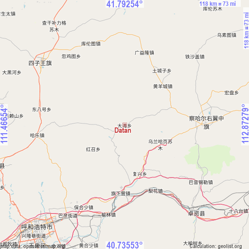
Datan GPS coordinates[2]
41° 15' 58.212" North, 112° 10' 10.776" East
| Map corner | latitude | longitude |
|---|---|---|
| Upper-left | 41.79254°, | 111.46654° |
| Center: | 41.26617°, | 112.16966° |
| Lower-right: | 40.73553°, | 112.87279° |
| Map W x H: | 117.5×117.5 km | = 73×73mi |
| max Lat: | 53.31946° ⇑10.3% North |
| Datan: | 41.26617° |
| min Lat: | ⇓89.7% South 18.22056° |
| min Long | Datan | max Long |
| 75.07348° | 112.16966° | 134.28917° |
| W 38.2%⇐ | ⇒61.8% E |
Elevation
Elevation of Datan is 1697 m = 5568 ft, and this is 1212.2 m = 3977 ft above average elevation for this country.
| Max E: |
5622 m = 18445 ft | 7.1% |
| Datan | 1697 m 5568 ft | |
| Avg. | 484.8 m = 1591 ft | |
Min E: |
-3 m = -10 ft | 92.9% |
See also: China elevation on elevation.city.
Geographical zone
Datan is located in North temperate zone (between Tropic of Cancer and the Arctic Circle). Distance of this Northern Tropic circle is 1982.4 km =1231.8 mi to South.| Distance of | km | miles | from Datan |
|---|---|---|---|
| North Pole | 5418.7 | 3367 | to North |
| Arctic Circle | 2812.8 | 1747.8 | to North |
| Tropic Cancer | 1982.4 | 1231.8 | to South |
| Equator | 4588.4 | 2851.1 | to South |


Nearby cities:
15 places around Datan: (largest is in red/bold)
• Bulianhe
36.9 km =22.9 mi,  49°
49°
• Dalanqi
37.8 km =23.5 mi,  249°
249°
• Erhaodi
23.7 km =14.7 mi,  86°
86°
• Guangchanglong
23.9 km =14.9 mi,  39°
39°
• Guangyilong
34.6 km =21.5 mi,  15°
15°
• Hobor
38.2 km =23.7 mi, 89°
• Huangyangcheng
25.7 km =16 mi, 44°
• Jinpen
35.9 km =22.3 mi,  134°
134°
• Menggusi
13 km =8.1 mi,  274°
274°
• Miliangju
25 km =15.5 mi,  72°
72°
• Qisumu
26.4 km =16.4 mi,  99°
99°
• Touhao
12.8 km =8 mi, 69°
• Tuchengzi
31.4 km =19.5 mi,  34°
34°
• Wuhao
31.5 km =19.6 mi, 19°
• Wulan Haye
19.7 km =12.2 mi,  118°
118°
Sources, notices
• [Note1] Compared only with cities in China existing in our database
• [Src1] Map data: © OpenStreetMap contributors (CC-BY-SA)
• [Src2] Other city data from geonames.org with taken over terms of usage.
• [Src3] Geographical zone / Annual Mean Temperature by Robert A. Rohde @ Wikipedia
