Wulan Haye geodata
Wulan Haye (Inner Mongolia) is a seat of a fourth-order administrative division; located in China in Asia/Shanghai (GMT+8) time zone. In our database, there are 1268 cities with bigger population. Compared to other cities in China, 89.5% of cities are located further ↓South; 60.7% of cities are located further →East and 91.6% of cities have lower elevation than Wulan Haye. Note1


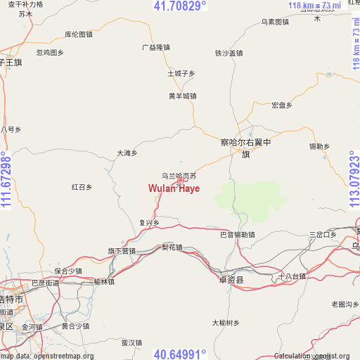
Wulan Haye GPS coordinates[2]
41° 10' 52.464" North, 112° 22' 33.96" East
| Map corner | latitude | longitude |
|---|---|---|
| Upper-left | 41.70829°, | 111.67298° |
| Center: | 41.18124°, | 112.3761° |
| Lower-right: | 40.64991°, | 113.07923° |
| Map W x H: | 117.7×117.7 km | = 73.1×73.1mi |
| max Lat: | 53.31946° ⇑10.5% North |
| Wulan Haye: | 41.18124° |
| min Lat: | ⇓89.5% South 18.22056° |
| min Long | Wulan Haye | max Long |
| 75.07348° | 112.3761° | 134.28917° |
| W 39.3%⇐ | ⇒60.7% E |
Elevation
Elevation of Wulan Haye is 1535 m = 5036 ft, and this is 1050.2 m = 3446 ft above average elevation for this country.
| Max E: |
5622 m = 18445 ft | 8.4% |
| Wulan Haye | 1535 m 5036 ft | |
| Avg. | 484.8 m = 1591 ft | |
Min E: |
-3 m = -10 ft | 91.6% |
See also: China elevation on elevation.city.
Geographical zone
Wulan Haye is located in North temperate zone (between Tropic of Cancer and the Arctic Circle). Distance of this Northern Tropic circle is 1973 km =1226 mi to South.| Distance of | km | miles | from Wulan Haye |
|---|---|---|---|
| North Pole | 5428.1 | 3372.9 | to North |
| Arctic Circle | 2822.2 | 1753.6 | to North |
| Tropic Cancer | 1973 | 1226 | to South |
| Equator | 4578.9 | 2845.2 | to South |


Nearby cities:
15 places around Wulan Haye: (largest is in red/bold)
• Bulianhe
35 km =21.7 mi,  18°
18°
• Datan
19.7 km =12.2 mi,  298°
298°
• Erhaodi
12.8 km =8 mi,  30°
30°
• Guangchanglong
28.1 km =17.5 mi,  355°
355°
• Hobor
23.2 km =14.4 mi,  64°
64°
• Huangyangcheng
27.9 km =17.3 mi,  1°
1°
• Jinpen
17.8 km =11.1 mi,  151°
151°
• Menggusi
32 km =19.9 mi,  288°
288°
• Miliangju
18.2 km =11.3 mi, 21°
• Qisumu
10.1 km =6.3 mi, 60°
• Sandaogou
31.7 km =19.7 mi,  46°
46°
• Touhao
14.8 km =9.2 mi,  339°
339°
• Tuchengzi
35.4 km =22 mi, 0°
• Yuanshanzi
31.2 km =19.4 mi,  65°
65°
• Zhuozishan
35 km =21.7 mi, 153°
Sources, notices
• [Note1] Compared only with cities in China existing in our database
• [Src1] Map data: © OpenStreetMap contributors (CC-BY-SA)
• [Src2] Other city data from geonames.org with taken over terms of usage.
• [Src3] Geographical zone / Annual Mean Temperature by Robert A. Rohde @ Wikipedia
