Baoshan geodata
Baoshan (Beijing) is a seat of a fourth-order administrative division; located in China in Asia/Shanghai (GMT+8) time zone. In our database, there are 1268 cities with bigger population. Compared to other cities in China, 88.5% of cities are located further ↓South; 63.4% of cities are located further ←West and 65.1% of cities have lower elevation than Baoshan. Note1


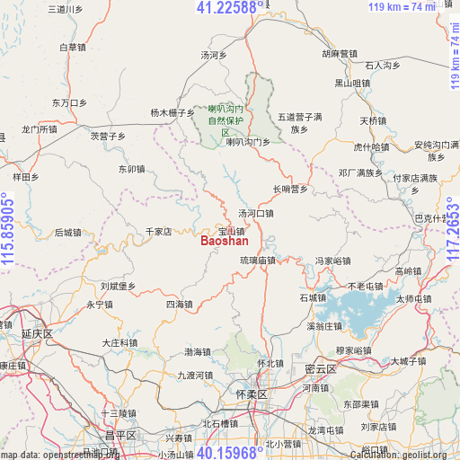
Baoshan GPS coordinates[2]
40° 41' 41.676" North, 116° 33' 43.812" East
| Map corner | latitude | longitude |
|---|---|---|
| Upper-left | 41.22588°, | 115.85905° |
| Center: | 40.69491°, | 116.56217° |
| Lower-right: | 40.15968°, | 117.2653° |
| Map W x H: | 118.6×118.5 km | = 73.7×73.6mi |
| max Lat: | 53.31946° ⇑11.5% North |
| Baoshan: | 40.69491° |
| min Lat: | ⇓88.5% South 18.22056° |
| min Long | Baoshan | max Long |
| 75.07348° | 116.56217° | 134.28917° |
| W 63.4%⇐ | ⇒36.6% E |
Elevation
Elevation of Baoshan is 328 m = 1076 ft, and this is 156.8 m = 514 ft below average elevation for this country.
| Max E: |
5622 m = 18445 ft | 34.9% |
| Avg. | 484.8 m = 1591 ft | |
| Baoshan | 328 m = 1076 ft | |
Min E: |
-3 m = -10 ft | 65.1% |
See also: China elevation on elevation.city.
Geographical zone
Baoshan is located in North temperate zone (between Tropic of Cancer and the Arctic Circle). Distance of this Northern Tropic circle is 1918.9 km =1192.3 mi to South.| Distance of | km | miles | from Baoshan |
|---|---|---|---|
| North Pole | 5482.2 | 3406.5 | to North |
| Arctic Circle | 2876.3 | 1787.2 | to North |
| Tropic Cancer | 1918.9 | 1192.3 | to South |
| Equator | 4524.8 | 2811.6 | to South |


Nearby cities:
15 places around Baoshan: (largest is in red/bold)
• Bohai
32.5 km =20.2 mi,  194°
194°
• Bulaotun
37.6 km =23.4 mi,  112°
112°
• Changshaoying
18.7 km =11.6 mi,  54°
54°
• Huaibei
35.5 km =22.1 mi,  161°
161°
• Laba Goumen
23 km =14.3 mi,  11°
11°
• Liubinbu
32.7 km =20.3 mi,  244°
244°
• Liulimiao
10.3 km =6.4 mi,  136°
136°
• Qianjiadian
18.6 km =11.6 mi,  269°
269°
• Shicheng
27.3 km =17 mi,  129°
129°
• Sihai
23.1 km =14.4 mi,  214°
214°
• Tanghekou
7.7 km =4.8 mi,  55°
55°
• Xiangying
37.8 km =23.5 mi,  248°
248°
• Xitiangezhuang
36.7 km =22.8 mi,  151°
151°
• Xiwengzhuang
34.2 km =21.3 mi, 136°
• Zhenzhuquan
19.6 km =12.2 mi,  218°
218°
Sources, notices
• [Note1] Compared only with cities in China existing in our database
• [Src1] Map data: © OpenStreetMap contributors (CC-BY-SA)
• [Src2] Other city data from geonames.org with taken over terms of usage.
• [Src3] Geographical zone / Annual Mean Temperature by Robert A. Rohde @ Wikipedia
