Bulaotun geodata
Bulaotun (Beijing) is a seat of a fourth-order administrative division; located in China in Asia/Shanghai (GMT+8) time zone. In our database, there are 1268 cities with bigger population. Compared to other cities in China, 88.2% of cities are located further ↓South; 65.9% of cities are located further ←West and 50.5% of cities have lower elevation than Bulaotun. Note1


Bulaotun GPS coordinates[2]
40° 34' 0.804" North, 116° 58' 26.832" East
| Map corner | latitude | longitude |
|---|---|---|
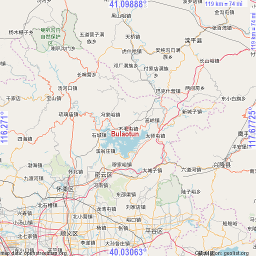
| Upper-left | 41.09888°, | 116.271° |
| Center: | 40.56689°, | 116.97412° |
| Lower-right: | 40.03063°, | 117.67725° |
| Map W x H: | 118.8×118.8 km | = 73.8×73.8mi |
| max Lat: | 53.31946° ⇑11.8% North |
| Bulaotun: | 40.56689° |
| min Lat: | ⇓88.2% South 18.22056° |
| min Long | Bulaotun | max Long |
| 75.07348° | 116.97412° | 134.28917° |
| W 65.9%⇐ | ⇒34.1% E |
Elevation
Elevation of Bulaotun is 169 m = 554 ft, and this is 315.8 m = 1036 ft below average elevation for this country.
| Max E: |
5622 m = 18445 ft | 49.5% |
| Avg. | 484.8 m = 1591 ft | |
| Bulaotun | 169 m = 554 ft | |
Min E: |
-3 m = -10 ft | 50.5% |
See also: China elevation on elevation.city.
Geographical zone
Bulaotun is located in North temperate zone (between Tropic of Cancer and the Arctic Circle). Distance of this Northern Tropic circle is 1904.7 km =1183.5 mi to South.| Distance of | km | miles | from Bulaotun |
|---|---|---|---|
| North Pole | 5496.4 | 3415.3 | to North |
| Arctic Circle | 2890.6 | 1796.1 | to North |
| Tropic Cancer | 1904.7 | 1183.5 | to South |
| Equator | 4510.6 | 2802.8 | to South |


Nearby cities:
15 places around Bulaotun: (largest is in red/bold)
• Beizhuang
17.7 km =11 mi,  111°
111°
• Dachengzi
22.3 km =13.9 mi,  150°
150°
• Gaoling
11.7 km =7.3 mi,  70°
70°
• Gubeikou
20.7 km =12.9 mi,  48°
48°
• Gulou
24.9 km =15.5 mi,  208°
208°
• Henanzhai
28.3 km =17.6 mi, 205°
• Jugezhuang
21.3 km =13.2 mi,  185°
185°
• Liulimiao
28.6 km =17.8 mi,  283°
283°
• Shicheng
13.9 km =8.6 mi,  257°
257°
• Shilibu
27.6 km =17.1 mi, 213°
• Taishitun
12.6 km =7.8 mi,  104°
104°
• Xinchengzi
30.5 km =19 mi, 74°
• Xitiangezhuang
25.3 km =15.7 mi,  224°
224°
• Xiwengzhuang
15.7 km =9.8 mi,  226°
226°
• Zhenluoying
28.7 km =17.8 mi, 151°
Sources, notices
• [Note1] Compared only with cities in China existing in our database
• [Src1] Map data: © OpenStreetMap contributors (CC-BY-SA)
• [Src2] Other city data from geonames.org with taken over terms of usage.
• [Src3] Geographical zone / Annual Mean Temperature by Robert A. Rohde @ Wikipedia
