Baoquanshan geodata
Baoquanshan (Jilin) is a seat of a fourth-order administrative division; located in China in Asia/Shanghai (GMT+8) time zone. In our database, there are 1268 cities with bigger population. Compared to other cities in China, 90.2% of cities are located further ↓South; 97.4% of cities are located further ←West and 83.7% of cities have lower elevation than Baoquanshan. Note1


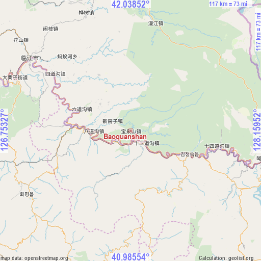
Baoquanshan GPS coordinates[2]
41° 30' 51.012" North, 127° 27' 23.004" East
| Map corner | latitude | longitude |
|---|---|---|
| Upper-left | 42.03852°, | 126.75327° |
| Center: | 41.51417°, | 127.45639° |
| Lower-right: | 40.98554°, | 128.15952° |
| Map W x H: | 117.1×117.1 km | = 72.8×72.8mi |
| max Lat: | 53.31946° ⇑9.8% North |
| Baoquanshan: | 41.51417° |
| min Lat: | ⇓90.2% South 18.22056° |
| min Long | Baoquanshan | max Long |
| 75.07348° | 127.45639° | 134.28917° |
| W 97.4%⇐ | ⇒2.6% E |
Elevation
Elevation of Baoquanshan is 896 m = 2940 ft, and this is 411.2 m = 1349 ft above average elevation for this country.
| Max E: |
5622 m = 18445 ft | 16.3% |
| Baoquanshan | 896 m 2940 ft | |
| Avg. | 484.8 m = 1591 ft | |
Min E: |
-3 m = -10 ft | 83.7% |
See also: China elevation on elevation.city.
Geographical zone
Baoquanshan is located in North temperate zone (between Tropic of Cancer and the Arctic Circle). Distance of this Northern Tropic circle is 2010 km =1249 mi to South.| Distance of | km | miles | from Baoquanshan |
|---|---|---|---|
| North Pole | 5391.1 | 3349.9 | to North |
| Arctic Circle | 2785.2 | 1730.6 | to North |
| Tropic Cancer | 2010 | 1249 | to South |
| Equator | 4615.9 | 2868.2 | to South |


Nearby cities:
15 places around Baoquanshan: (largest is in red/bold)
• Badaogou
16 km =9.9 mi,  271°
271°
• Baoshan
18 km =11.2 mi,  310°
310°
• Dongbeicha
28.5 km =17.7 mi,  330°
330°
• Huashu
56.6 km =35.2 mi,  339°
339°
• Jiajiaying
37.8 km =23.5 mi,  324°
324°
• Jinhua
48.5 km =30.1 mi,  101°
101°
• Linjiang
56 km =34.8 mi, 305°
• Liudaogou
24.5 km =15.2 mi,  294°
294°
• Manjiang
49.5 km =30.8 mi,  13°
13°
• Mayihe
44 km =27.3 mi, 319°
• Shisandaogou
28.5 km =17.7 mi,  109°
109°
• Shisidaogou
39.4 km =24.5 mi, 100°
• Shi’erdaogou
9.2 km =5.7 mi,  127°
127°
• Sidaogou
42.3 km =26.3 mi, 307°
• Xinfangzi
9.2 km =5.7 mi,  299°
299°
Sources, notices
• [Note1] Compared only with cities in China existing in our database
• [Src1] Map data: © OpenStreetMap contributors (CC-BY-SA)
• [Src2] Other city data from geonames.org with taken over terms of usage.
• [Src3] Geographical zone / Annual Mean Temperature by Robert A. Rohde @ Wikipedia
