Pianling geodata
Pianling (Liaoning) is a seat of a fourth-order administrative division; located in China in Asia/Shanghai (GMT+8) time zone. In our database, there are 1268 cities with bigger population. Compared to other cities in China, 88% of cities are located further ↓South; 92.8% of cities are located further ←West and 54.5% of cities have lower elevation than Pianling. Note1


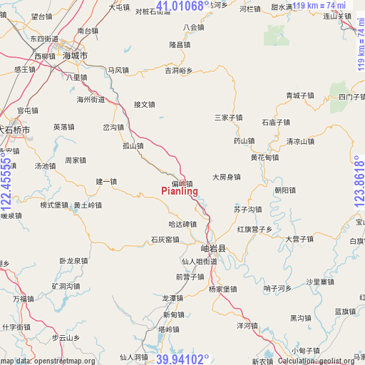
Pianling GPS coordinates[2]
40° 28' 40.728" North, 123° 9' 31.212" East
| Map corner | latitude | longitude |
|---|---|---|
| Upper-left | 41.01068°, | 122.45555° |
| Center: | 40.47798°, | 123.15867° |
| Lower-right: | 39.94102°, | 123.8618° |
| Map W x H: | 118.9×118.9 km | = 73.9×73.9mi |
| max Lat: | 53.31946° ⇑12% North |
| Pianling: | 40.47798° |
| min Lat: | ⇓88% South 18.22056° |
| min Long | Pianling | max Long |
| 75.07348° | 123.15867° | 134.28917° |
| W 92.8%⇐ | ⇒7.2% E |
Elevation
Elevation of Pianling is 202 m = 663 ft, and this is 282.8 m = 928 ft below average elevation for this country.
| Max E: |
5622 m = 18445 ft | 45.5% |
| Avg. | 484.8 m = 1591 ft | |
| Pianling | 202 m = 663 ft | |
Min E: |
-3 m = -10 ft | 54.5% |
See also: China elevation on elevation.city.
Geographical zone
Pianling is located in North temperate zone (between Tropic of Cancer and the Arctic Circle). Distance of this Northern Tropic circle is 1894.8 km =1177.4 mi to South.| Distance of | km | miles | from Pianling |
|---|---|---|---|
| North Pole | 5506.3 | 3421.5 | to North |
| Arctic Circle | 2900.4 | 1802.2 | to North |
| Tropic Cancer | 1894.8 | 1177.4 | to South |
| Equator | 4500.7 | 2796.6 | to South |


Nearby cities:
15 places around Pianling: (largest is in red/bold)
• Dafangshen
14.6 km =9.1 mi,  82°
82°
• Gushan
20.3 km =12.6 mi,  306°
306°
• Hadabei
15.1 km =9.4 mi,  181°
181°
• Hanghuadian
27.7 km =17.2 mi,  71°
71°
• Hongqi Yingzi
28.5 km =17.7 mi,  124°
124°
• Jianyi
24.9 km =15.5 mi,  271°
271°
• Jiewen
28.7 km =17.8 mi,  333°
333°
• Jiucaigou
22.1 km =13.7 mi,  55°
55°
• Lüwang
25.7 km =16 mi,  250°
250°
• Muniu
20.8 km =12.9 mi,  15°
15°
• Sanjiazi
25.7 km =16 mi,  34°
34°
• Shihuiyao
18.9 km =11.7 mi,  193°
193°
• Suzigou
22.8 km =14.2 mi,  112°
112°
• Xinglong
21.9 km =13.6 mi,  150°
150°
• Xiuyan
22.8 km =14.2 mi, 154°
Sources, notices
• [Note1] Compared only with cities in China existing in our database
• [Src1] Map data: © OpenStreetMap contributors (CC-BY-SA)
• [Src2] Other city data from geonames.org with taken over terms of usage.
• [Src3] Geographical zone / Annual Mean Temperature by Robert A. Rohde @ Wikipedia
