Lefutang geodata
Lefutang (Hunan) is a seat of a fourth-order administrative division; located in China in Asia/Shanghai (GMT+8) time zone. In our database, there are 1268 cities with bigger population. Compared to other cities in China, 83.7% of cities are located further ↑North; 65% of cities are located further →East and 68.2% of cities have lower elevation than Lefutang. Note1


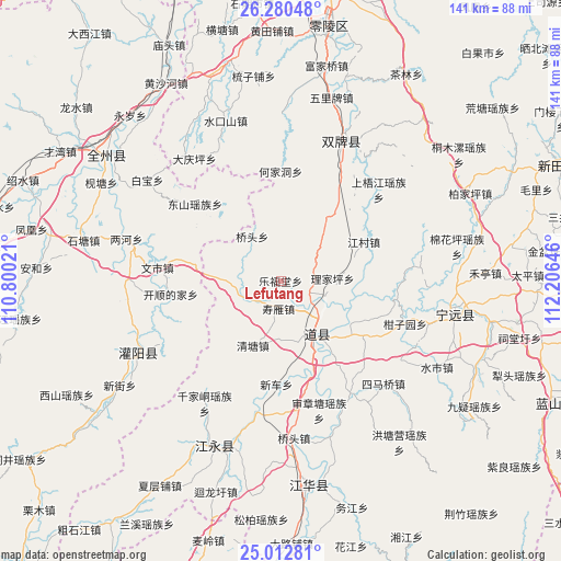
Lefutang GPS coordinates[2]
25° 38' 53.988" North, 111° 30' 11.988" East
| Map corner | latitude | longitude |
|---|---|---|
| Upper-left | 26.28048°, | 110.80021° |
| Center: | 25.64833°, | 111.50333° |
| Lower-right: | 25.01281°, | 112.20646° |
| Map W x H: | 141×141 km | = 87.6×87.6mi |
| max Lat: | 53.31946° ⇑83.7% North |
| Lefutang: | 25.64833° |
| min Lat: | ⇓16.3% South 18.22056° |
| min Long | Lefutang | max Long |
| 75.07348° | 111.50333° | 134.28917° |
| W 35%⇐ | ⇒65% E |
Elevation
Elevation of Lefutang is 380 m = 1247 ft, and this is 104.8 m = 344 ft below average elevation for this country.
| Max E: |
5622 m = 18445 ft | 31.8% |
| Avg. | 484.8 m = 1591 ft | |
| Lefutang | 380 m = 1247 ft | |
Min E: |
-3 m = -10 ft | 68.2% |
See also: China elevation on elevation.city.
Geographical zone
Lefutang is located in North temperate zone (between Tropic of Cancer and the Arctic Circle). Distance of this Northern Tropic circle is 245.9 km =152.8 mi to South.| Distance of | km | miles | from Lefutang |
|---|---|---|---|
| North Pole | 7155.2 | 4446 | to North |
| Arctic Circle | 4549.3 | 2826.8 | to North |
| Tropic Cancer | 245.9 | 152.8 | to South |
| Equator | 2851.8 | 1772 | to South |


Nearby cities:
15 places around Lefutang: (largest is in red/bold)
• Baimadu
21.6 km =13.4 mi,  120°
120°
• Baimangpu
23.6 km =14.7 mi, 122°
• Daojiang
15 km =9.3 mi,  148°
148°
• Daojiang
17.6 km =10.9 mi,  164°
164°
• Dongmen
17.4 km =10.8 mi,  142°
142°
• Futang
13.8 km =8.6 mi, 135°
• Hejiadong
26.5 km =16.5 mi,  359°
359°
• Longbo
33.4 km =20.8 mi,  20°
20°
• Shangjiangxu
33.4 km =20.8 mi,  193°
193°
• Shangrenli
30.6 km =19 mi,  27°
27°
• Shenzhangtang
34 km =21.1 mi, 163°
• Shouyan
8.6 km =5.3 mi,  180°
180°
• Wanjiazhuang
18 km =11.2 mi, 157°
• Xinche
26 km =16.2 mi, 182°
• Yongjiang
28.6 km =17.8 mi, 17°
Sources, notices
• [Note1] Compared only with cities in China existing in our database
• [Src1] Map data: © OpenStreetMap contributors (CC-BY-SA)
• [Src2] Other city data from geonames.org with taken over terms of usage.
• [Src3] Geographical zone / Annual Mean Temperature by Robert A. Rohde @ Wikipedia
