Qiaotou geodata
Qiaotou (Hunan) is a seat of a fourth-order administrative division; located in China in Asia/Shanghai (GMT+8) time zone. In our database, there are 1268 cities with bigger population. Compared to other cities in China, 85.2% of cities are located further ↑North; 64.9% of cities are located further →East and 59.9% of cities have lower elevation than Qiaotou. Note1


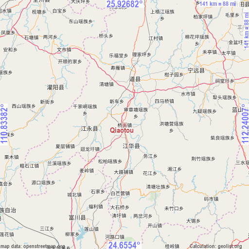
Qiaotou GPS coordinates[2]
25° 17' 34.008" North, 111° 32' 12.984" East
| Map corner | latitude | longitude |
|---|---|---|
| Upper-left | 25.92682°, | 110.83382° |
| Center: | 25.29278°, | 111.53694° |
| Lower-right: | 24.6554°, | 112.24007° |
| Map W x H: | 141.4×141.4 km | = 87.9×87.9mi |
| max Lat: | 53.31946° ⇑85.2% North |
| Qiaotou: | 25.29278° |
| min Lat: | ⇓14.8% South 18.22056° |
| min Long | Qiaotou | max Long |
| 75.07348° | 111.53694° | 134.28917° |
| W 35.1%⇐ | ⇒64.9% E |
Elevation
Elevation of Qiaotou is 258 m = 846 ft, and this is 226.8 m = 744 ft below average elevation for this country.
| Max E: |
5622 m = 18445 ft | 40.1% |
| Avg. | 484.8 m = 1591 ft | |
| Qiaotou | 258 m = 846 ft | |
Min E: |
-3 m = -10 ft | 59.9% |
See also: China elevation on elevation.city.
Geographical zone
Qiaotou is located in North temperate zone (between Tropic of Cancer and the Arctic Circle). Distance of this Northern Tropic circle is 206.4 km =128.3 mi to South.| Distance of | km | miles | from Qiaotou |
|---|---|---|---|
| North Pole | 7194.8 | 4470.6 | to North |
| Arctic Circle | 4588.9 | 2851.4 | to North |
| Tropic Cancer | 206.4 | 128.3 | to South |
| Equator | 2812.3 | 1747.5 | to South |


Nearby cities:
15 places around Qiaotou: (largest is in red/bold)
• Daojiang
22.6 km =14 mi,  3°
3°
• Daojiang
27.1 km =16.8 mi,  9°
9°
• Dongmen
26.7 km =16.6 mi,  15°
15°
• Dongtian
19.5 km =12.1 mi,  144°
144°
• Hengling
20.1 km =12.5 mi,  75°
75°
• Qianjiadong
23.1 km =14.4 mi,  292°
292°
• Shangjiangxu
13.1 km =8.1 mi,  302°
302°
• Shenzhangtang
9.4 km =5.8 mi,  42°
42°
• Simaqiao
26.4 km =16.4 mi,  58°
58°
• Songbo
22.1 km =13.7 mi,  201°
201°
• Tuojiang
12.3 km =7.6 mi,  163°
163°
• Wanjiazhuang
23.2 km =14.4 mi, 8°
• Xiaopu
19.4 km =12.1 mi,  266°
266°
• Xiaopu
22.9 km =14.2 mi,  254°
254°
• Xinche
14.2 km =8.8 mi,  341°
341°
Sources, notices
• [Note1] Compared only with cities in China existing in our database
• [Src1] Map data: © OpenStreetMap contributors (CC-BY-SA)
• [Src2] Other city data from geonames.org with taken over terms of usage.
• [Src3] Geographical zone / Annual Mean Temperature by Robert A. Rohde @ Wikipedia
