Xuebu geodata
Xuebu (Jiangsu) is a seat of a fourth-order administrative division; located in China in Asia/Shanghai (GMT+8) time zone. In our database, there are 1268 cities with bigger population. Compared to other cities in China, 59.5% of cities are located further ↓South; 78.2% of cities are located further ←West and 89.9% of cities have higher elevation than Xuebu. Note1


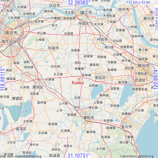
Xuebu GPS coordinates[2]
31° 42' 27.396" North, 119° 23' 39.372" East
| Map corner | latitude | longitude |
|---|---|---|
| Upper-left | 32.30385°, | 118.69115° |
| Center: | 31.70761°, | 119.39427° |
| Lower-right: | 31.10751°, | 120.0974° |
| Map W x H: | 133×133 km | = 82.6×82.6mi |
| max Lat: | 53.31946° ⇑40.5% North |
| Xuebu: | 31.70761° |
| min Lat: | ⇓59.5% South 18.22056° |
| min Long | Xuebu | max Long |
| 75.07348° | 119.39427° | 134.28917° |
| W 78.2%⇐ | ⇒21.8% E |
Elevation
Elevation of Xuebu is 10 m = 33 ft, and this is 474.8 m = 1558 ft below average elevation for this country.
| Max E: |
5622 m = 18445 ft | 89.9% |
| Avg. | 484.8 m = 1591 ft | |
| Xuebu | 10 m = 33 ft | |
Min E: |
-3 m = -10 ft | 10.1% |
See also: China elevation on elevation.city.
Geographical zone
Xuebu is located in North temperate zone (between Tropic of Cancer and the Arctic Circle). Distance of this Northern Tropic circle is 919.6 km =571.4 mi to South.| Distance of | km | miles | from Xuebu |
|---|---|---|---|
| North Pole | 6481.5 | 4027.4 | to North |
| Arctic Circle | 3875.6 | 2408.2 | to North |
| Tropic Cancer | 919.6 | 571.4 | to South |
| Equator | 3525.6 | 2190.7 | to South |


Nearby cities:
15 places around Xuebu: (largest is in red/bold)
• Baoyan
23.9 km =14.9 mi,  351°
351°
• Bieqiao
17.8 km =11.1 mi,  159°
159°
• Houbai
23.2 km =14.4 mi,  298°
298°
• Hutang
21.3 km =13.2 mi,  154°
154°
• Jianchang
15.7 km =9.8 mi,  36°
36°
• Jincheng
17.5 km =10.9 mi,  76°
76°
• Maoshan
13.2 km =8.2 mi,  315°
315°
• Tianwang
18.6 km =11.6 mi,  283°
283°
• Xuebu
2.6 km =1.6 mi, 297°
• Yanling
20.8 km =12.9 mi,  22°
22°
• Zhiqian
13.3 km =8.3 mi,  137°
137°
• Zhixi
12.3 km =7.6 mi,  26°
26°
• Zhulin
6.7 km =4.2 mi,  58°
58°
• Zhuze
17 km =10.6 mi,  190°
190°
• Zhuze
17.6 km =10.9 mi,  202°
202°
Sources, notices
• [Note1] Compared only with cities in China existing in our database
• [Src1] Map data: © OpenStreetMap contributors (CC-BY-SA)
• [Src2] Other city data from geonames.org with taken over terms of usage.
• [Src3] Geographical zone / Annual Mean Temperature by Robert A. Rohde @ Wikipedia
