Jiashan geodata
Jiashan (Zhejiang) is a section of populated place; located in China in Asia/Shanghai (GMT+8) time zone. With population of 137,112 people, there are 321 cities with bigger population in this country. Compared to other cities in China, 53.4% of cities are located further ↓South; 87.5% of cities are located further ←West and 94.3% of cities have higher elevation than Jiashan. Note1


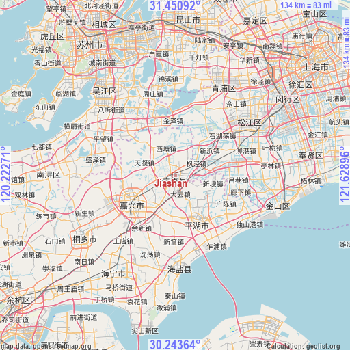
Jiashan GPS coordinates[2]
30° 50' 57.048" North, 120° 55' 32.988" East
| Map corner | latitude | longitude |
|---|---|---|
| Upper-left | 31.45092°, | 120.22271° |
| Center: | 30.84918°, | 120.92583° |
| Lower-right: | 30.24364°, | 121.62896° |
| Map W x H: | 134.2×134.2 km | = 83.4×83.4mi |
| max Lat: | 53.31946° ⇑46.6% North |
| Jiashan: | 30.84918° |
| min Lat: | ⇓53.4% South 18.22056° |
| min Long | Jiashan | max Long |
| 75.07348° | 120.92583° | 134.28917° |
| W 87.5%⇐ | ⇒12.5% E |
Elevation
Elevation of Jiashan is 7 m = 23 ft, and this is 477.8 m = 1568 ft below average elevation for this country.
| Max E: |
5622 m = 18445 ft | 94.3% |
| Avg. | 484.8 m = 1591 ft | |
| Jiashan | 7 m = 23 ft | |
Min E: |
-3 m = -10 ft | 5.7% |
See also: Jiashan elevation on elevation.city.
Geographical zone
Jiashan is located in North temperate zone (between Tropic of Cancer and the Arctic Circle). Distance of this Northern Tropic circle is 824.2 km =512.1 mi to South.| Distance of | km | miles | from Jiashan |
|---|---|---|---|
| North Pole | 6577 | 4086.8 | to North |
| Arctic Circle | 3971.1 | 2467.5 | to North |
| Tropic Cancer | 824.2 | 512.1 | to South |
| Equator | 3430.1 | 2131.4 | to South |


Nearby cities:
15 places around Jiashan: (largest is in red/bold)
• Daqiao
13.1 km =8.1 mi,  210°
210°
• Dayun
7.6 km =4.7 mi,  165°
165°
• Fengjing
9.4 km =5.8 mi,  60°
60°
• Ganyao
5.9 km =3.7 mi,  318°
318°
• Hongxi
10.8 km =6.7 mi,  309°
309°
• Huimin
4.4 km =2.7 mi,  104°
104°
• Qixing
11.6 km =7.2 mi,  249°
249°
• Tanghui
15.9 km =9.9 mi, 247°
• Tianning
13 km =8.1 mi,  293°
293°
• Weitang
1.4 km =0.9 mi,  274°
274°
• Xindai
15.2 km =9.4 mi, 101°
• Xinfeng
15.6 km =9.7 mi,  182°
182°
• Xitang
11.5 km =7.1 mi,  341°
341°
• Yangmiao
10.2 km =6.3 mi, 273°
• Yaozhuang
7.8 km =4.8 mi,  22°
22°
Sources, notices
• [Note1] Compared only with cities in China existing in our database
• [Src1] Map data: © OpenStreetMap contributors (CC-BY-SA)
• [Src2] Other city data from geonames.org with taken over terms of usage.
• [Src3] Geographical zone / Annual Mean Temperature by Robert A. Rohde @ Wikipedia
