Zhongba geodata
Zhongba (Gansu) is a seat of a fourth-order administrative division; located in China in Asia/Shanghai (GMT+8) time zone. In our database, there are 1268 cities with bigger population. Compared to other cities in China, 70.2% of cities are located further ↓South; 89% of cities are located further →East and 92.4% of cities have lower elevation than Zhongba. Note1


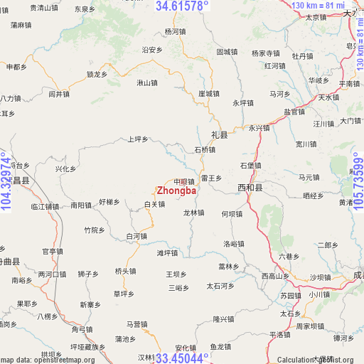
Zhongba GPS coordinates[2]
34° 2' 6.396" North, 105° 1' 58.296" East
| Map corner | latitude | longitude |
|---|---|---|
| Upper-left | 34.61578°, | 104.32974° |
| Center: | 34.03511°, | 105.03286° |
| Lower-right: | 33.45044°, | 105.73599° |
| Map W x H: | 129.6×129.6 km | = 80.5×80.5mi |
| max Lat: | 53.31946° ⇑29.8% North |
| Zhongba: | 34.03511° |
| min Lat: | ⇓70.2% South 18.22056° |
| min Long | Zhongba | max Long |
| 75.07348° | 105.03286° | 134.28917° |
| W 11%⇐ | ⇒89% E |
Elevation
Elevation of Zhongba is 1622 m = 5322 ft, and this is 1137.2 m = 3731 ft above average elevation for this country.
| Max E: |
5622 m = 18445 ft | 7.6% |
| Zhongba | 1622 m 5322 ft | |
| Avg. | 484.8 m = 1591 ft | |
Min E: |
-3 m = -10 ft | 92.4% |
See also: China elevation on elevation.city.
Geographical zone
Zhongba is located in North temperate zone (between Tropic of Cancer and the Arctic Circle). Distance of this Northern Tropic circle is 1178.4 km =732.2 mi to South.| Distance of | km | miles | from Zhongba |
|---|---|---|---|
| North Pole | 6222.7 | 3866.6 | to North |
| Arctic Circle | 3616.8 | 2247.4 | to North |
| Tropic Cancer | 1178.4 | 732.2 | to South |
| Equator | 3784.3 | 2351.5 | to South |


Nearby cities:
15 places around Zhongba: (largest is in red/bold)
• Baiguan
13.3 km =8.3 mi,  234°
234°
• Baihe
24.8 km =15.4 mi,  222°
222°
• Hanyuan
24 km =14.9 mi,  96°
96°
• Haoli
21.3 km =13.2 mi,  254°
254°
• Heba
20.2 km =12.6 mi,  123°
123°
• Hekou
20.9 km =13 mi,  148°
148°
• Jiangkou
6.7 km =4.2 mi,  67°
67°
• Jiangxi
15.9 km =9.9 mi, 104°
• Leiwang
10.4 km =6.5 mi,  80°
80°
• Longlin
10.7 km =6.6 mi,  162°
162°
• Shibao
25.2 km =15.7 mi, 75°
• Shili
25.7 km =16 mi,  111°
111°
• Suhe
17.7 km =11 mi, 80°
• Tanping
25.5 km =15.8 mi,  192°
192°
• Zhaowu
26.1 km =16.2 mi, 102°
Sources, notices
• [Note1] Compared only with cities in China existing in our database
• [Src1] Map data: © OpenStreetMap contributors (CC-BY-SA)
• [Src2] Other city data from geonames.org with taken over terms of usage.
• [Src3] Geographical zone / Annual Mean Temperature by Robert A. Rohde @ Wikipedia
