Yanghuxiang geodata
Yanghuxiang (Jiangxi) is a seat of a fourth-order administrative division; located in China in Asia/Shanghai (GMT+8) time zone. In our database, there are 1268 cities with bigger population. Compared to other cities in China, 73.9% of cities are located further ↑North; 57% of cities are located further ←West and 76.2% of cities have higher elevation than Yanghuxiang. Note1


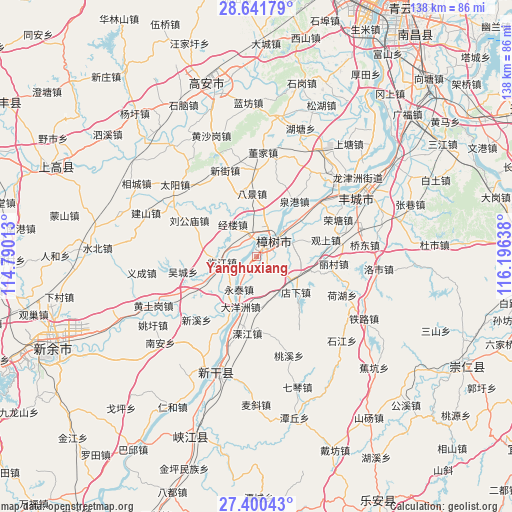
Yanghuxiang GPS coordinates[2]
28° 1' 22.44" North, 115° 29' 35.7" East
| Map corner | latitude | longitude |
|---|---|---|
| Upper-left | 28.64179°, | 114.79013° |
| Center: | 28.0229°, | 115.49325° |
| Lower-right: | 27.40043°, | 116.19638° |
| Map W x H: | 138×138 km | = 85.7×85.7mi |
| max Lat: | 53.31946° ⇑73.9% North |
| Yanghuxiang: | 28.0229° |
| min Lat: | ⇓26.1% South 18.22056° |
| min Long | Yanghuxiang | max Long |
| 75.07348° | 115.49325° | 134.28917° |
| W 57%⇐ | ⇒43% E |
Elevation
Elevation of Yanghuxiang is 34 m = 112 ft, and this is 450.8 m = 1479 ft below average elevation for this country.
| Max E: |
5622 m = 18445 ft | 76.2% |
| Avg. | 484.8 m = 1591 ft | |
| Yanghuxiang | 34 m = 112 ft | |
Min E: |
-3 m = -10 ft | 23.8% |
See also: China elevation on elevation.city.
Geographical zone
Yanghuxiang is located in North temperate zone (between Tropic of Cancer and the Arctic Circle). Distance of this Northern Tropic circle is 509.9 km =316.8 mi to South.| Distance of | km | miles | from Yanghuxiang |
|---|---|---|---|
| North Pole | 6891.2 | 4282 | to North |
| Arctic Circle | 4285.3 | 2662.8 | to North |
| Tropic Cancer | 509.9 | 316.8 | to South |
| Equator | 3115.9 | 1936.1 | to South |


Nearby cities:
15 places around Yanghuxiang: (largest is in red/bold)
• Bajing
17.2 km =10.7 mi,  356°
356°
• Changfu
21.6 km =13.4 mi,  238°
238°
• Daqiao
9.3 km =5.8 mi,  67°
67°
• Dayangzhou
14.3 km =8.9 mi,  197°
197°
• Dianxia
14.3 km =8.9 mi,  132°
132°
• Jinglou
10.8 km =6.7 mi,  322°
322°
• Licun
20.4 km =12.7 mi,  98°
98°
• Lijiang
20.7 km =12.9 mi,  187°
187°
• Liugongmiao
20.8 km =12.9 mi,  297°
297°
• Quangang
17.9 km =11.1 mi,  34°
34°
• Sanhu
12.7 km =7.9 mi,  210°
210°
• Tuochuan
21.9 km =13.6 mi,  48°
48°
• Yongtai
10.2 km =6.3 mi, 209°
• Zhangjiashan
7.1 km =4.4 mi,  348°
348°
• Zhoushang
8.5 km =5.3 mi,  256°
256°
Sources, notices
• [Note1] Compared only with cities in China existing in our database
• [Src1] Map data: © OpenStreetMap contributors (CC-BY-SA)
• [Src2] Other city data from geonames.org with taken over terms of usage.
• [Src3] Geographical zone / Annual Mean Temperature by Robert A. Rohde @ Wikipedia
