Pingya geodata
Pingya (Gansu) is a seat of a fourth-order administrative division; located in China in Asia/Shanghai (GMT+8) time zone. In our database, there are 1268 cities with bigger population. Compared to other cities in China, 68.1% of cities are located further ↓South; 89.5% of cities are located further →East and 92.6% of cities have lower elevation than Pingya. Note1


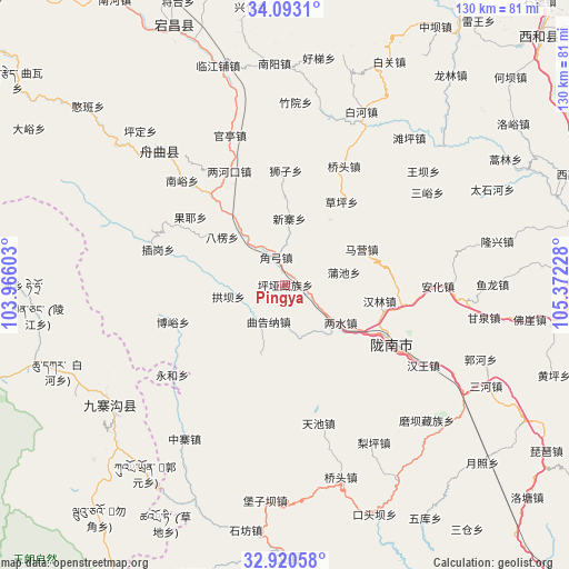
Pingya GPS coordinates[2]
33° 30' 31.788" North, 104° 40' 8.94" East
| Map corner | latitude | longitude |
|---|---|---|
| Upper-left | 34.0931°, | 103.96603° |
| Center: | 33.50883°, | 104.66915° |
| Lower-right: | 32.92058°, | 105.37228° |
| Map W x H: | 130.4×130.4 km | = 81×81mi |
| max Lat: | 53.31946° ⇑31.9% North |
| Pingya: | 33.50883° |
| min Lat: | ⇓68.1% South 18.22056° |
| min Long | Pingya | max Long |
| 75.07348° | 104.66915° | 134.28917° |
| W 10.5%⇐ | ⇒89.5% E |
Elevation
Elevation of Pingya is 1659 m = 5443 ft, and this is 1174.2 m = 3852 ft above average elevation for this country.
| Max E: |
5622 m = 18445 ft | 7.4% |
| Pingya | 1659 m 5443 ft | |
| Avg. | 484.8 m = 1591 ft | |
Min E: |
-3 m = -10 ft | 92.6% |
See also: China elevation on elevation.city.
Geographical zone
Pingya is located in North temperate zone (between Tropic of Cancer and the Arctic Circle). Distance of this Northern Tropic circle is 1119.9 km =695.9 mi to South.| Distance of | km | miles | from Pingya |
|---|---|---|---|
| North Pole | 6281.2 | 3903 | to North |
| Arctic Circle | 3675.3 | 2283.7 | to North |
| Tropic Cancer | 1119.9 | 695.9 | to South |
| Equator | 3725.8 | 2315.1 | to South |


Nearby cities:
15 places around Pingya: (largest is in red/bold)
• Baleng
18.1 km =11.2 mi,  307°
307°
• Caoping
22.9 km =14.2 mi,  34°
34°
• Chiba
18.6 km =11.6 mi, 34°
• Danian
9.6 km =6 mi,  202°
202°
• Gongba
13.3 km =8.3 mi,  258°
258°
• Hanlin
21.9 km =13.6 mi,  99°
99°
• Jiaogong
6.6 km =4.1 mi,  341°
341°
• Jinping
15.5 km =9.6 mi,  137°
137°
• Liangshui
15.6 km =9.7 mi,  123°
123°
• Maying
19.1 km =11.9 mi,  59°
59°
• Puchi
13.7 km =8.5 mi,  77°
77°
• Shawan
16.4 km =10.2 mi,  323°
323°
• Shimen
6.9 km =4.3 mi,  111°
111°
• Tieba
17 km =10.6 mi, 196°
• Xinzhai
15.1 km =9.4 mi,  5°
5°
Sources, notices
• [Note1] Compared only with cities in China existing in our database
• [Src1] Map data: © OpenStreetMap contributors (CC-BY-SA)
• [Src2] Other city data from geonames.org with taken over terms of usage.
• [Src3] Geographical zone / Annual Mean Temperature by Robert A. Rohde @ Wikipedia
