Dianga geodata
Dianga (Gansu) is a seat of a third-order administrative division; located in China in Asia/Shanghai (GMT+8) time zone. In our database, there are 1268 cities with bigger population. Compared to other cities in China, 70.4% of cities are located further ↓South; 91.2% of cities are located further →East and 95.9% of cities have lower elevation than Dianga. Note1


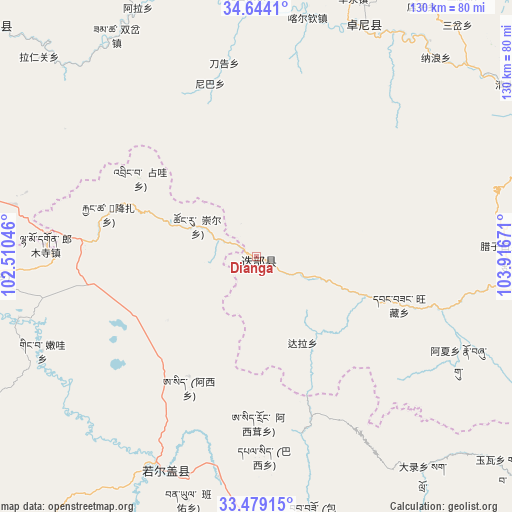
Dianga GPS coordinates[2]
34° 3' 49.068" North, 103° 12' 48.888" East
| Map corner | latitude | longitude |
|---|---|---|
| Upper-left | 34.6441°, | 102.51046° |
| Center: | 34.06363°, | 103.21358° |
| Lower-right: | 33.47915°, | 103.91671° |
| Map W x H: | 129.5×129.5 km | = 80.5×80.5mi |
| max Lat: | 53.31946° ⇑29.6% North |
| Dianga: | 34.06363° |
| min Lat: | ⇓70.4% South 18.22056° |
| min Long | Dianga | max Long |
| 75.07348° | 103.21358° | 134.28917° |
| W 8.8%⇐ | ⇒91.2% E |
Elevation
Elevation of Dianga is 2499 m = 8199 ft, and this is 2014.2 m = 6608 ft above average elevation for this country.
| Max E: |
5622 m = 18445 ft | 4.1% |
| Dianga | 2499 m 8199 ft | |
| Avg. | 484.8 m = 1591 ft | |
Min E: |
-3 m = -10 ft | 95.9% |
See also: China elevation on elevation.city.
Geographical zone
Dianga is located in North temperate zone (between Tropic of Cancer and the Arctic Circle). Distance of this Northern Tropic circle is 1181.6 km =734.2 mi to South.| Distance of | km | miles | from Dianga |
|---|---|---|---|
| North Pole | 6219.5 | 3864.6 | to North |
| Arctic Circle | 3613.7 | 2245.4 | to North |
| Tropic Cancer | 1181.6 | 734.2 | to South |
| Equator | 3787.5 | 2353.4 | to South |


Nearby cities:
15 places around Dianga: (largest is in red/bold)
• Chubu
62.1 km =38.6 mi,  6°
6°
• Daogao
49.5 km =30.8 mi,  350°
350°
• Dazhasi
58.7 km =36.5 mi,  203°
203°
• Dazu
60.8 km =37.8 mi,  18°
18°
• Huayuan
52.2 km =32.4 mi,  101°
101°
• Kaba
27.5 km =17.1 mi,  109°
109°
• Kache
61.1 km =38 mi, 11°
• Lazi
62.7 km =39 mi,  89°
89°
• Liulin
64.3 km =40 mi, 24°
• Mu’er
65.5 km =40.7 mi,  31°
31°
• Niba
45.4 km =28.2 mi,  344°
344°
• Ni’ao
33.1 km =20.6 mi, 110°
• Sangba
53.2 km =33.1 mi, 92°
• Wangcang
37.8 km =23.5 mi, 109°
• Yiwa
9.2 km =5.7 mi,  333°
333°
Sources, notices
• [Note1] Compared only with cities in China existing in our database
• [Src1] Map data: © OpenStreetMap contributors (CC-BY-SA)
• [Src2] Other city data from geonames.org with taken over terms of usage.
• [Src3] Geographical zone / Annual Mean Temperature by Robert A. Rohde @ Wikipedia
