Sangba geodata
Sangba (Gansu) is a seat of a fourth-order administrative division; located in China in Asia/Shanghai (GMT+8) time zone. In our database, there are 1268 cities with bigger population. Compared to other cities in China, 70.2% of cities are located further ↓South; 90.6% of cities are located further →East and 95.1% of cities have lower elevation than Sangba. Note1


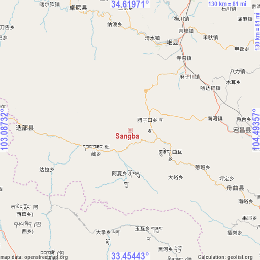
Sangba GPS coordinates[2]
34° 2' 20.652" North, 103° 47' 25.584" East
| Map corner | latitude | longitude |
|---|---|---|
| Upper-left | 34.61971°, | 103.08732° |
| Center: | 34.03907°, | 103.79044° |
| Lower-right: | 33.45443°, | 104.49357° |
| Map W x H: | 129.6×129.6 km | = 80.5×80.5mi |
| max Lat: | 53.31946° ⇑29.8% North |
| Sangba: | 34.03907° |
| min Lat: | ⇓70.2% South 18.22056° |
| min Long | Sangba | max Long |
| 75.07348° | 103.79044° | 134.28917° |
| W 9.4%⇐ | ⇒90.6% E |
Elevation
Elevation of Sangba is 2150 m = 7054 ft, and this is 1665.2 m = 5463 ft above average elevation for this country.
| Max E: |
5622 m = 18445 ft | 4.9% |
| Sangba | 2150 m 7054 ft | |
| Avg. | 484.8 m = 1591 ft | |
Min E: |
-3 m = -10 ft | 95.1% |
See also: China elevation on elevation.city.
Geographical zone
Sangba is located in North temperate zone (between Tropic of Cancer and the Arctic Circle). Distance of this Northern Tropic circle is 1178.9 km =732.5 mi to South.| Distance of | km | miles | from Sangba |
|---|---|---|---|
| North Pole | 6222.3 | 3866.4 | to North |
| Arctic Circle | 3616.4 | 2247.1 | to North |
| Tropic Cancer | 1178.9 | 732.5 | to South |
| Equator | 3784.8 | 2351.8 | to South |


Nearby cities:
15 places around Sangba: (largest is in red/bold)
• Bazang
27.4 km =17 mi,  123°
123°
• Dayu
32.6 km =20.3 mi,  135°
135°
• Hanban
40.8 km =25.4 mi, 116°
• Huayuan
8.4 km =5.2 mi,  194°
194°
• Kaba
28 km =17.4 mi,  256°
256°
• Lazi
10 km =6.2 mi,  72°
72°
• Lijie
30.1 km =18.7 mi, 120°
• Luoda
18.5 km =11.5 mi,  108°
108°
• Nanhe
42.5 km =26.4 mi,  81°
81°
• Ni’ao
23.8 km =14.8 mi,  248°
248°
• Qinxu
41.1 km =25.5 mi,  27°
27°
• Quwa
23 km =14.3 mi,  125°
125°
• Shili
45.2 km =28.1 mi,  19°
19°
• Sigou
45 km =28 mi,  36°
36°
• Wangcang
20.1 km =12.5 mi,  240°
240°
Sources, notices
• [Note1] Compared only with cities in China existing in our database
• [Src1] Map data: © OpenStreetMap contributors (CC-BY-SA)
• [Src2] Other city data from geonames.org with taken over terms of usage.
• [Src3] Geographical zone / Annual Mean Temperature by Robert A. Rohde @ Wikipedia
