Beiwa geodata
Beiwa (Ningxia Hui Autonomous Region) is a seat of a fourth-order administrative division; located in China in Asia/Shanghai (GMT+8) time zone. In our database, there are 1268 cities with bigger population. Compared to other cities in China, 77.5% of cities are located further ↓South; 84.8% of cities are located further →East and 93.4% of cities have lower elevation than Beiwa. Note1


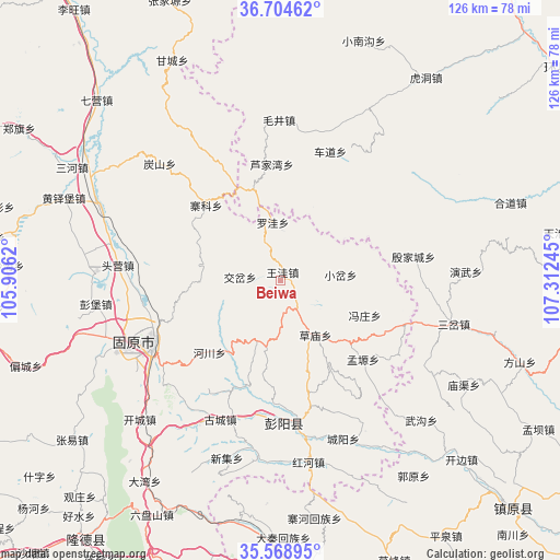
Beiwa GPS coordinates[2]
36° 8' 19.824" North, 106° 36' 33.552" East
| Map corner | latitude | longitude |
|---|---|---|
| Upper-left | 36.70462°, | 105.9062° |
| Center: | 36.13884°, | 106.60932° |
| Lower-right: | 35.56895°, | 107.31245° |
| Map W x H: | 126.3×126.3 km | = 78.5×78.5mi |
| max Lat: | 53.31946° ⇑22.5% North |
| Beiwa: | 36.13884° |
| min Lat: | ⇓77.5% South 18.22056° |
| min Long | Beiwa | max Long |
| 75.07348° | 106.60932° | 134.28917° |
| W 15.2%⇐ | ⇒84.8% E |
Elevation
Elevation of Beiwa is 1767 m = 5797 ft, and this is 1282.2 m = 4207 ft above average elevation for this country.
| Max E: |
5622 m = 18445 ft | 6.6% |
| Beiwa | 1767 m 5797 ft | |
| Avg. | 484.8 m = 1591 ft | |
Min E: |
-3 m = -10 ft | 93.4% |
See also: China elevation on elevation.city.
Geographical zone
Beiwa is located in North temperate zone (between Tropic of Cancer and the Arctic Circle). Distance of this Northern Tropic circle is 1412.3 km =877.6 mi to South.| Distance of | km | miles | from Beiwa |
|---|---|---|---|
| North Pole | 5988.8 | 3721.3 | to North |
| Arctic Circle | 3382.9 | 2102 | to North |
| Tropic Cancer | 1412.3 | 877.6 | to South |
| Equator | 4018.3 | 2496.9 | to South |


Nearby cities:
15 places around Beiwa: (largest is in red/bold)
• Caomiao
14.6 km =9.1 mi,  146°
146°
• Chedao
31.2 km =19.4 mi,  21°
21°
• Chengjiao
31.7 km =19.7 mi,  242°
242°
• Gonghe
23.1 km =14.4 mi,  250°
250°
• Guanting
17.7 km =11 mi,  278°
278°
• Jiaocha
9 km =5.6 mi, 275°
• Lujiawan
26.3 km =16.3 mi,  354°
354°
• Luowa
13.7 km =8.5 mi, 349°
• Maqu
31.3 km =19.4 mi,  336°
336°
• Shicha
15.5 km =9.6 mi,  200°
200°
• Xiaocha
13.6 km =8.5 mi,  83°
83°
• Xiawangwa
4.4 km =2.7 mi, 146°
• Xinshan
31.7 km =19.7 mi,  319°
319°
• Yinjiacheng
30.3 km =18.8 mi, 79°
• Zhaike
23.8 km =14.8 mi, 315°
Sources, notices
• [Note1] Compared only with cities in China existing in our database
• [Src1] Map data: © OpenStreetMap contributors (CC-BY-SA)
• [Src2] Other city data from geonames.org with taken over terms of usage.
• [Src3] Geographical zone / Annual Mean Temperature by Robert A. Rohde @ Wikipedia
