Gaofeng geodata
Gaofeng (Jiangxi) is a seat of a fourth-order administrative division; located in China in Asia/Shanghai (GMT+8) time zone. In our database, there are 1268 cities with bigger population. Compared to other cities in China, 58.1% of cities are located further ↑North; 57.3% of cities are located further ←West and 73.7% of cities have higher elevation than Gaofeng. Note1


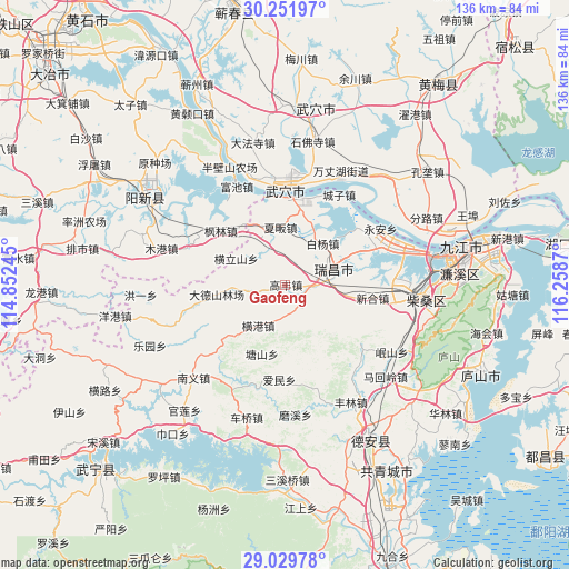
Gaofeng GPS coordinates[2]
29° 38' 33.828" North, 115° 33' 20.052" East
| Map corner | latitude | longitude |
|---|---|---|
| Upper-left | 30.25197°, | 114.85245° |
| Center: | 29.64273°, | 115.55557° |
| Lower-right: | 29.02978°, | 116.2587° |
| Map W x H: | 135.9×135.9 km | = 84.4×84.4mi |
| max Lat: | 53.31946° ⇑58.1% North |
| Gaofeng: | 29.64273° |
| min Lat: | ⇓41.9% South 18.22056° |
| min Long | Gaofeng | max Long |
| 75.07348° | 115.55557° | 134.28917° |
| W 57.3%⇐ | ⇒42.7% E |
Elevation
Elevation of Gaofeng is 40 m = 131 ft, and this is 444.8 m = 1459 ft below average elevation for this country.
| Max E: |
5622 m = 18445 ft | 73.7% |
| Avg. | 484.8 m = 1591 ft | |
| Gaofeng | 40 m = 131 ft | |
Min E: |
-3 m = -10 ft | 26.3% |
See also: China elevation on elevation.city.
Geographical zone
Gaofeng is located in North temperate zone (between Tropic of Cancer and the Arctic Circle). Distance of this Northern Tropic circle is 690 km =428.7 mi to South.| Distance of | km | miles | from Gaofeng |
|---|---|---|---|
| North Pole | 6711.1 | 4170.1 | to North |
| Arctic Circle | 4105.2 | 2550.9 | to North |
| Tropic Cancer | 690 | 428.7 | to South |
| Equator | 3296 | 2048 | to South |


Nearby cities:
15 places around Gaofeng: (largest is in red/bold)
• Baiyang
13.6 km =8.5 mi,  41°
41°
• Fanzhen
6.7 km =4.2 mi,  172°
172°
• Fenglin
20.3 km =12.6 mi,  310°
310°
• Henggang
11.6 km =7.2 mi,  214°
214°
• Henglishan
13.3 km =8.3 mi,  298°
298°
• Huangjin
16.5 km =10.3 mi,  334°
334°
• Leshan
9.7 km =6 mi,  234°
234°
• Nanyang
10.9 km =6.8 mi,  339°
339°
• Neihu
16.8 km =10.4 mi, 300°
• Tangshan
17.3 km =10.7 mi,  199°
199°
• Wujiao
15.4 km =9.6 mi,  24°
24°
• Xiafan
13.9 km =8.6 mi,  354°
354°
• Xinhe
20.8 km =12.9 mi,  97°
97°
• Xintang
15.5 km =9.6 mi, 99°
• Yongquan
11.3 km =7 mi, 104°
Sources, notices
• [Note1] Compared only with cities in China existing in our database
• [Src1] Map data: © OpenStreetMap contributors (CC-BY-SA)
• [Src2] Other city data from geonames.org with taken over terms of usage.
• [Src3] Geographical zone / Annual Mean Temperature by Robert A. Rohde @ Wikipedia
