Kazi geodata
Kazi (Tibet) is a seat of a fourth-order administrative division; located in China in Asia/Shanghai (GMT+8) time zone. In our database, there are 1268 cities with bigger population. Compared to other cities in China, 58.8% of cities are located further ↑North; 97.7% of cities are located further →East and 98.5% of cities have lower elevation than Kazi. Note1


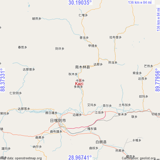
Kazi GPS coordinates[2]
29° 34' 50.628" North, 89° 4' 35.148" East
| Map corner | latitude | longitude |
|---|---|---|
| Upper-left | 30.19035°, | 88.37331° |
| Center: | 29.58073°, | 89.07643° |
| Lower-right: | 28.96741°, | 89.77956° |
| Map W x H: | 136×136 km | = 84.5×84.5mi |
| max Lat: | 53.31946° ⇑58.8% North |
| Kazi: | 29.58073° |
| min Lat: | ⇓41.2% South 18.22056° |
| min Long | Kazi | max Long |
| 75.07348° | 89.07643° | 134.28917° |
| W 2.3%⇐ | ⇒97.7% E |
Elevation
Elevation of Kazi is 3946 m = 12946 ft, and this is 3461.2 m = 11356 ft above average elevation for this country.
| Max E: |
5622 m = 18445 ft | 1.5% |
| Kazi | 3946 m 12946 ft | |
| Avg. | 484.8 m = 1591 ft | |
Min E: |
-3 m = -10 ft | 98.5% |
See also: China elevation on elevation.city.
Geographical zone
Kazi is located in North temperate zone (between Tropic of Cancer and the Arctic Circle). Distance of this Northern Tropic circle is 683.1 km =424.5 mi to South.| Distance of | km | miles | from Kazi |
|---|---|---|---|
| North Pole | 6718 | 4174.4 | to North |
| Arctic Circle | 4112.1 | 2555.1 | to North |
| Tropic Cancer | 683.1 | 424.5 | to South |
| Equator | 3289.1 | 2043.8 | to South |


Nearby cities:
15 places around Kazi: (largest is in red/bold)
• Bazha
44.5 km =27.7 mi,  172°
172°
• Bianxiong
29.2 km =18.1 mi,  184°
184°
• Car
31.4 km =19.5 mi,  132°
132°
• Dana
20.7 km =12.9 mi,  48°
48°
• Dobjoi
5.5 km =3.4 mi,  196°
196°
• Gadong
42.1 km =26.2 mi, 166°
• Gyamco
31.4 km =19.5 mi,  19°
19°
• Jangdam
31.6 km =19.6 mi,  148°
148°
• Lhabupu
43.2 km =26.8 mi,  43°
43°
• Namling
11.8 km =7.3 mi,  9°
9°
• Pundam
36.2 km =22.5 mi, 6°
• Qum
8.4 km =5.2 mi,  315°
315°
• Ratang
32.1 km =19.9 mi,  61°
61°
• Renwu
7.4 km =4.6 mi,  291°
291°
• Rikaze
41.3 km =25.7 mi,  206°
206°
Sources, notices
• [Note1] Compared only with cities in China existing in our database
• [Src1] Map data: © OpenStreetMap contributors (CC-BY-SA)
• [Src2] Other city data from geonames.org with taken over terms of usage.
• [Src3] Geographical zone / Annual Mean Temperature by Robert A. Rohde @ Wikipedia
