Car geodata
Car (Tibet) is a seat of a fourth-order administrative division; located in China in Asia/Shanghai (GMT+8) time zone. In our database, there are 1268 cities with bigger population. Compared to other cities in China, 60.9% of cities are located further ↑North; 97.5% of cities are located further →East and 98.2% of cities have lower elevation than Car. Note1


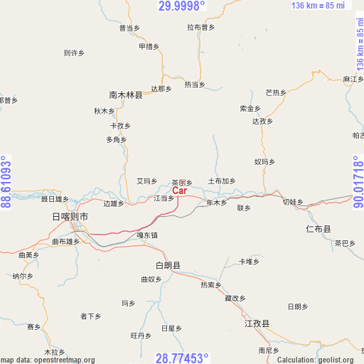
Car GPS coordinates[2]
29° 23' 20.436" North, 89° 18' 50.58" East
| Map corner | latitude | longitude |
|---|---|---|
| Upper-left | 29.9998°, | 88.61093° |
| Center: | 29.38901°, | 89.31405° |
| Lower-right: | 28.77453°, | 90.01718° |
| Map W x H: | 136.2×136.2 km | = 84.6×84.6mi |
| max Lat: | 53.31946° ⇑60.9% North |
| Car: | 29.38901° |
| min Lat: | ⇓39.1% South 18.22056° |
| min Long | Car | max Long |
| 75.07348° | 89.31405° | 134.28917° |
| W 2.5%⇐ | ⇒97.5% E |
Elevation
Elevation of Car is 3809 m = 12497 ft, and this is 3324.2 m = 10906 ft above average elevation for this country.
| Max E: |
5622 m = 18445 ft | 1.8% |
| Car | 3809 m 12497 ft | |
| Avg. | 484.8 m = 1591 ft | |
Min E: |
-3 m = -10 ft | 98.2% |
See also: China elevation on elevation.city.
Geographical zone
Car is located in North temperate zone (between Tropic of Cancer and the Arctic Circle). Distance of this Northern Tropic circle is 661.8 km =411.2 mi to South.| Distance of | km | miles | from Car |
|---|---|---|---|
| North Pole | 6739.3 | 4187.6 | to North |
| Arctic Circle | 4133.4 | 2568.4 | to North |
| Tropic Cancer | 661.8 | 411.2 | to South |
| Equator | 3267.8 | 2030.5 | to South |


Nearby cities:
15 places around Car: (largest is in red/bold)
• Bazha
28.3 km =17.6 mi,  216°
216°
• Bianxiong
26.7 km =16.6 mi,  253°
253°
• Dana
36 km =22.4 mi,  347°
347°
• Dobjoi
29.3 km =18.2 mi,  303°
303°
• Gadong
23.6 km =14.7 mi,  213°
213°
• Jangdam
8.7 km =5.4 mi,  229°
229°
• Karmai
33.3 km =20.7 mi,  148°
148°
• Kazi
31.4 km =19.5 mi,  312°
312°
• Lian
25 km =15.5 mi,  112°
112°
• Luobuqiongzi
25.5 km =15.8 mi,  194°
194°
• Luojiang
31.9 km =19.8 mi, 188°
• Nianmu
14.8 km =9.2 mi,  120°
120°
• Nubma
32.3 km =20.1 mi,  74°
74°
• Qiangdui
33.8 km =21 mi,  171°
171°
• Suojin
36.4 km =22.6 mi,  41°
41°
Sources, notices
• [Note1] Compared only with cities in China existing in our database
• [Src1] Map data: © OpenStreetMap contributors (CC-BY-SA)
• [Src2] Other city data from geonames.org with taken over terms of usage.
• [Src3] Geographical zone / Annual Mean Temperature by Robert A. Rohde @ Wikipedia
