Nubma geodata
Nubma (Tibet) is a seat of a fourth-order administrative division; located in China in Asia/Shanghai (GMT+8) time zone. In our database, there are 1268 cities with bigger population. Compared to other cities in China, 60.1% of cities are located further ↑North; 97.3% of cities are located further →East and 98.7% of cities have lower elevation than Nubma. Note1


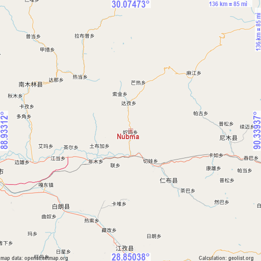
Nubma GPS coordinates[2]
29° 27' 51.84" North, 89° 38' 10.464" East
| Map corner | latitude | longitude |
|---|---|---|
| Upper-left | 30.07473°, | 88.93312° |
| Center: | 29.4644°, | 89.63624° |
| Lower-right: | 28.85038°, | 90.33937° |
| Map W x H: | 136.1×136.1 km | = 84.6×84.6mi |
| max Lat: | 53.31946° ⇑60.1% North |
| Nubma: | 29.4644° |
| min Lat: | ⇓39.9% South 18.22056° |
| min Long | Nubma | max Long |
| 75.07348° | 89.63624° | 134.28917° |
| W 2.7%⇐ | ⇒97.3% E |
Elevation
Elevation of Nubma is 4050 m = 13287 ft, and this is 3565.2 m = 11697 ft above average elevation for this country.
| Max E: |
5622 m = 18445 ft | 1.3% |
| Nubma | 4050 m 13287 ft | |
| Avg. | 484.8 m = 1591 ft | |
Min E: |
-3 m = -10 ft | 98.7% |
See also: China elevation on elevation.city.
Geographical zone
Nubma is located in North temperate zone (between Tropic of Cancer and the Arctic Circle). Distance of this Northern Tropic circle is 670.2 km =416.4 mi to South.| Distance of | km | miles | from Nubma |
|---|---|---|---|
| North Pole | 6730.9 | 4182.4 | to North |
| Arctic Circle | 4125 | 2563.2 | to North |
| Tropic Cancer | 670.2 | 416.4 | to South |
| Equator | 3276.1 | 2035.7 | to South |


Nearby cities:
15 places around Nubma: (largest is in red/bold)
• Car
32.3 km =20.1 mi,  254°
254°
• Dazi
15.4 km =9.6 mi,  354°
354°
• Dejilin
37.4 km =23.2 mi,  142°
142°
• Jangdam
40.3 km =25 mi, 249°
• Kardoi
38.4 km =23.9 mi,  189°
189°
• Karmai
39.1 km =24.3 mi,  200°
200°
• Lian
19.5 km =12.1 mi, 204°
• Mu
23.4 km =14.5 mi,  147°
147°
• Narong
35.8 km =22.2 mi,  182°
182°
• Nianmu
24.3 km =15.1 mi,  229°
229°
• Qiangqinxue
33.7 km =20.9 mi,  130°
130°
• Qiewa
18.4 km =11.4 mi, 146°
• Ratang
38.3 km =23.8 mi,  317°
317°
• Rinbung
27.6 km =17.1 mi, 142°
• Suojin
20.4 km =12.7 mi,  339°
339°
Sources, notices
• [Note1] Compared only with cities in China existing in our database
• [Src1] Map data: © OpenStreetMap contributors (CC-BY-SA)
• [Src2] Other city data from geonames.org with taken over terms of usage.
• [Src3] Geographical zone / Annual Mean Temperature by Robert A. Rohde @ Wikipedia
