Suojin geodata
Suojin (Tibet) is a seat of a fourth-order administrative division; located in China in Asia/Shanghai (GMT+8) time zone. In our database, there are 1268 cities with bigger population. Compared to other cities in China, 58.1% of cities are located further ↑North; 97.4% of cities are located further →East and 99.2% of cities have lower elevation than Suojin. Note1


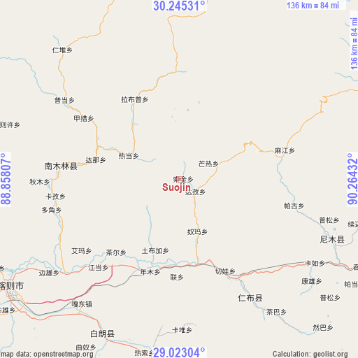
Suojin GPS coordinates[2]
29° 38' 9.708" North, 89° 33' 40.284" East
| Map corner | latitude | longitude |
|---|---|---|
| Upper-left | 30.24531°, | 88.85807° |
| Center: | 29.63603°, | 89.56119° |
| Lower-right: | 29.02304°, | 90.26432° |
| Map W x H: | 135.9×135.9 km | = 84.4×84.4mi |
| max Lat: | 53.31946° ⇑58.1% North |
| Suojin: | 29.63603° |
| min Lat: | ⇓41.9% South 18.22056° |
| min Long | Suojin | max Long |
| 75.07348° | 89.56119° | 134.28917° |
| W 2.6%⇐ | ⇒97.4% E |
Elevation
Elevation of Suojin is 4279 m = 14039 ft, and this is 3794.2 m = 12448 ft above average elevation for this country.
| Max E: |
5622 m = 18445 ft | 0.8% |
| Suojin | 4279 m 14039 ft | |
| Avg. | 484.8 m = 1591 ft | |
Min E: |
-3 m = -10 ft | 99.2% |
See also: China elevation on elevation.city.
Geographical zone
Suojin is located in North temperate zone (between Tropic of Cancer and the Arctic Circle). Distance of this Northern Tropic circle is 689.3 km =428.3 mi to South.| Distance of | km | miles | from Suojin |
|---|---|---|---|
| North Pole | 6711.8 | 4170.5 | to North |
| Arctic Circle | 4106 | 2551.3 | to North |
| Tropic Cancer | 689.3 | 428.3 | to South |
| Equator | 3295.2 | 2047.5 | to South |


Nearby cities:
15 places around Suojin: (largest is in red/bold)
• Car
36.4 km =22.6 mi,  221°
221°
• Dana
32.4 km =20.1 mi,  283°
283°
• Dazi
6.8 km =4.2 mi,  123°
123°
• Gyamco
43.1 km =26.8 mi,  302°
302°
• Jangdam
45 km =28 mi, 222°
• Kazi
47.3 km =29.4 mi,  262°
262°
• Lhabupu
30.6 km =19 mi,  325°
325°
• Lian
36.9 km =22.9 mi,  181°
181°
• Mu
43.6 km =27.1 mi,  152°
152°
• Namling
45.3 km =28.1 mi, 276°
• Nianmu
36.7 km =22.8 mi,  197°
197°
• Nubma
20.4 km =12.7 mi,  159°
159°
• Qiewa
38.6 km =24 mi, 153°
• Ratang
20.7 km =12.9 mi, 296°
• Rinbung
47.5 km =29.5 mi, 149°
Sources, notices
• [Note1] Compared only with cities in China existing in our database
• [Src1] Map data: © OpenStreetMap contributors (CC-BY-SA)
• [Src2] Other city data from geonames.org with taken over terms of usage.
• [Src3] Geographical zone / Annual Mean Temperature by Robert A. Rohde @ Wikipedia
