Yangxoi geodata
Yangxoi (Tibet) is a seat of a fourth-order administrative division; located in China in Asia/Shanghai (GMT+8) time zone. In our database, there are 1268 cities with bigger population. Compared to other cities in China, 56.4% of cities are located further ↓South; 96.4% of cities are located further →East and 99.3% of cities have lower elevation than Yangxoi. Note1


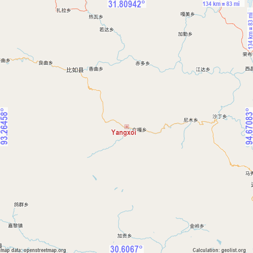
Yangxoi GPS coordinates[2]
31° 12' 35.892" North, 93° 58' 3.72" East
| Map corner | latitude | longitude |
|---|---|---|
| Upper-left | 31.80942°, | 93.26458° |
| Center: | 31.20997°, | 93.9677° |
| Lower-right: | 30.6067°, | 94.67083° |
| Map W x H: | 133.7×133.7 km | = 83.1×83.1mi |
| max Lat: | 53.31946° ⇑43.6% North |
| Yangxoi: | 31.20997° |
| min Lat: | ⇓56.4% South 18.22056° |
| min Long | Yangxoi | max Long |
| 75.07348° | 93.9677° | 134.28917° |
| W 3.6%⇐ | ⇒96.4% E |
Elevation
Elevation of Yangxoi is 4338 m = 14232 ft, and this is 3853.2 m = 12642 ft above average elevation for this country.
| Max E: |
5622 m = 18445 ft | 0.7% |
| Yangxoi | 4338 m 14232 ft | |
| Avg. | 484.8 m = 1591 ft | |
Min E: |
-3 m = -10 ft | 99.3% |
See also: China elevation on elevation.city.
Geographical zone
Yangxoi is located in North temperate zone (between Tropic of Cancer and the Arctic Circle). Distance of this Northern Tropic circle is 864.3 km =537.1 mi to South.| Distance of | km | miles | from Yangxoi |
|---|---|---|---|
| North Pole | 6536.8 | 4061.8 | to North |
| Arctic Circle | 3931 | 2442.6 | to North |
| Tropic Cancer | 864.3 | 537.1 | to South |
| Equator | 3470.2 | 2156.3 | to South |


Nearby cities:
15 places around Yangxoi: (largest is in red/bold)
• Biru
41 km =25.5 mi,  317°
317°
• Biruxong
40.8 km =25.4 mi,  301°
301°
• Chiduo
34.3 km =21.3 mi,  14°
14°
• Gamei
66.9 km =41.6 mi,  26°
26°
• Jaggong
57.2 km =35.5 mi,  181°
181°
• Jamda
50 km =31.1 mi,  52°
52°
• Jiaqin
56.5 km =35.1 mi, 30°
• Jiling
66 km =41 mi,  144°
144°
• Lainqu
55.2 km =34.3 mi,  309°
309°
• Nyinmo
35.5 km =22.1 mi,  83°
83°
• Paingar
6.6 km =4.1 mi,  101°
101°
• Rawa
58.6 km =36.4 mi,  346°
346°
• Rogda
53.1 km =33 mi, 349°
• Shading
50.5 km =31.4 mi, 83°
• Xamqu
35 km =21.7 mi,  330°
330°
Sources, notices
• [Note1] Compared only with cities in China existing in our database
• [Src1] Map data: © OpenStreetMap contributors (CC-BY-SA)
• [Src2] Other city data from geonames.org with taken over terms of usage.
• [Src3] Geographical zone / Annual Mean Temperature by Robert A. Rohde @ Wikipedia
