Lainqu geodata
Lainqu (Tibet) is a seat of a fourth-order administrative division; located in China in Asia/Shanghai (GMT+8) time zone. In our database, there are 1268 cities with bigger population. Compared to other cities in China, 58.5% of cities are located further ↓South; 96.5% of cities are located further →East and 99.3% of cities have lower elevation than Lainqu. Note1


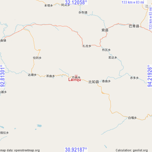
Lainqu GPS coordinates[2]
31° 31' 23.34" North, 93° 30' 58.068" East
| Map corner | latitude | longitude |
|---|---|---|
| Upper-left | 32.12058°, | 92.81301° |
| Center: | 31.52315°, | 93.51613° |
| Lower-right: | 30.92187°, | 94.21926° |
| Map W x H: | 133.3×133.3 km | = 82.8×82.8mi |
| max Lat: | 53.31946° ⇑41.5% North |
| Lainqu: | 31.52315° |
| min Lat: | ⇓58.5% South 18.22056° |
| min Long | Lainqu | max Long |
| 75.07348° | 93.51613° | 134.28917° |
| W 3.5%⇐ | ⇒96.5% E |
Elevation
Elevation of Lainqu is 4304 m = 14121 ft, and this is 3819.2 m = 12530 ft above average elevation for this country.
| Max E: |
5622 m = 18445 ft | 0.7% |
| Lainqu | 4304 m 14121 ft | |
| Avg. | 484.8 m = 1591 ft | |
Min E: |
-3 m = -10 ft | 99.3% |
See also: China elevation on elevation.city.
Geographical zone
Lainqu is located in North temperate zone (between Tropic of Cancer and the Arctic Circle). Distance of this Northern Tropic circle is 899.1 km =558.7 mi to South.| Distance of | km | miles | from Lainqu |
|---|---|---|---|
| North Pole | 6502 | 4040.2 | to North |
| Arctic Circle | 3896.1 | 2420.9 | to North |
| Tropic Cancer | 899.1 | 558.7 | to South |
| Equator | 3505 | 2177.9 | to South |


Nearby cities:
15 places around Lainqu: (largest is in red/bold)
• Biru
15.9 km =9.9 mi,  106°
106°
• Biruxong
15.8 km =9.8 mi,  149°
149°
• Caqu
22.2 km =13.8 mi,  270°
270°
• Chiduo
51.6 km =32.1 mi,  91°
91°
• Dartang
64.6 km =40.1 mi,  45°
45°
• Paingar
61.1 km =38 mi,  126°
126°
• Qiaze
38.4 km =23.9 mi,  302°
302°
• Rawa
36.1 km =22.4 mi, 52°
• Rogda
37 km =23 mi,  62°
62°
• Sexiong
66.1 km =41.1 mi,  258°
258°
• Xamqu
26.2 km =16.3 mi,  99°
99°
• Yag La
48 km =29.8 mi,  30°
30°
• Yangxoi
55.2 km =34.3 mi, 129°
• Zaindainxoi
39 km =24.2 mi,  21°
21°
• Zala
28.3 km =17.6 mi, 18°
Sources, notices
• [Note1] Compared only with cities in China existing in our database
• [Src1] Map data: © OpenStreetMap contributors (CC-BY-SA)
• [Src2] Other city data from geonames.org with taken over terms of usage.
• [Src3] Geographical zone / Annual Mean Temperature by Robert A. Rohde @ Wikipedia
