Baiqiao geodata
Baiqiao (Chongqing) is a seat of a fourth-order administrative division; located in China in Asia/Shanghai (GMT+8) time zone. In our database, there are 1268 cities with bigger population. Compared to other cities in China, 56.9% of cities are located further ↓South; 78.2% of cities are located further →East and 83.2% of cities have lower elevation than Baiqiao. Note1


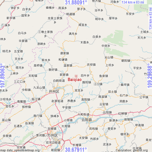
Baiqiao GPS coordinates[2]
31° 16' 54.912" North, 108° 35' 37.5" East
| Map corner | latitude | longitude |
|---|---|---|
| Upper-left | 31.88091°, | 107.89063° |
| Center: | 31.28192°, | 108.59375° |
| Lower-right: | 30.67911°, | 109.29688° |
| Map W x H: | 133.6×133.6 km | = 83×83mi |
| max Lat: | 53.31946° ⇑43.1% North |
| Baiqiao: | 31.28192° |
| min Lat: | ⇓56.9% South 18.22056° |
| min Long | Baiqiao | max Long |
| 75.07348° | 108.59375° | 134.28917° |
| W 21.8%⇐ | ⇒78.2% E |
Elevation
Elevation of Baiqiao is 861 m = 2825 ft, and this is 376.2 m = 1234 ft above average elevation for this country.
| Max E: |
5622 m = 18445 ft | 16.8% |
| Baiqiao | 861 m 2825 ft | |
| Avg. | 484.8 m = 1591 ft | |
Min E: |
-3 m = -10 ft | 83.2% |
See also: China elevation on elevation.city.
Geographical zone
Baiqiao is located in North temperate zone (between Tropic of Cancer and the Arctic Circle). Distance of this Northern Tropic circle is 872.3 km =542 mi to South.| Distance of | km | miles | from Baiqiao |
|---|---|---|---|
| North Pole | 6528.8 | 4056.8 | to North |
| Arctic Circle | 3923 | 2437.6 | to North |
| Tropic Cancer | 872.3 | 542 | to South |
| Equator | 3478.2 | 2161.3 | to South |


Nearby cities:
15 places around Baiqiao: (largest is in red/bold)
• Baihe
12.5 km =7.8 mi,  260°
260°
• Fengle
19.9 km =12.4 mi,  238°
238°
• Guojia
10.8 km =6.7 mi,  277°
277°
• Heqian
18.9 km =11.7 mi,  321°
321°
• Heyan
11 km =6.8 mi,  41°
41°
• Houba
11.9 km =7.4 mi,  224°
224°
• Houye
7.9 km =4.9 mi,  84°
84°
• Jiangkou
20.1 km =12.5 mi,  109°
109°
• Jinfeng
10.3 km =6.4 mi,  197°
197°
• Luyang
10.4 km =6.5 mi,  119°
119°
• Nongba
17.5 km =10.9 mi,  52°
52°
• Qukou
19.4 km =12.1 mi,  214°
214°
• Quma
16.5 km =10.3 mi,  172°
172°
• Shuanglong
12.5 km =7.8 mi, 168°
• Wenquan
10.9 km =6.8 mi, 321°
Sources, notices
• [Note1] Compared only with cities in China existing in our database
• [Src1] Map data: © OpenStreetMap contributors (CC-BY-SA)
• [Src2] Other city data from geonames.org with taken over terms of usage.
• [Src3] Geographical zone / Annual Mean Temperature by Robert A. Rohde @ Wikipedia
