Beiyang geodata
Beiyang (Zhejiang) is a seat of a fourth-order administrative division; located in China in Asia/Shanghai (GMT+8) time zone. In our database, there are 1268 cities with bigger population. Compared to other cities in China, 68.7% of cities are located further ↑North; 88.2% of cities are located further ←West and 86.2% of cities have higher elevation than Beiyang. Note1


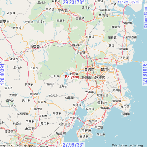
Beiyang GPS coordinates[2]
28° 36' 58.932" North, 121° 6' 25.308" East
| Map corner | latitude | longitude |
|---|---|---|
| Upper-left | 29.23178°, | 120.40391° |
| Center: | 28.61637°, | 121.10703° |
| Lower-right: | 27.99733°, | 121.81016° |
| Map W x H: | 137.3×137.3 km | = 85.3×85.3mi |
| max Lat: | 53.31946° ⇑68.7% North |
| Beiyang: | 28.61637° |
| min Lat: | ⇓31.3% South 18.22056° |
| min Long | Beiyang | max Long |
| 75.07348° | 121.10703° | 134.28917° |
| W 88.2%⇐ | ⇒11.8% E |
Elevation
Elevation of Beiyang is 14 m = 46 ft, and this is 470.8 m = 1545 ft below average elevation for this country.
| Max E: |
5622 m = 18445 ft | 86.2% |
| Avg. | 484.8 m = 1591 ft | |
| Beiyang | 14 m = 46 ft | |
Min E: |
-3 m = -10 ft | 13.8% |
See also: China elevation on elevation.city.
Geographical zone
Beiyang is located in North temperate zone (between Tropic of Cancer and the Arctic Circle). Distance of this Northern Tropic circle is 575.9 km =357.8 mi to South.| Distance of | km | miles | from Beiyang |
|---|---|---|---|
| North Pole | 6825.2 | 4241 | to North |
| Arctic Circle | 4219.3 | 2621.8 | to North |
| Tropic Cancer | 575.9 | 357.8 | to South |
| Equator | 3181.8 | 1977.1 | to South |


Nearby cities:
15 places around Beiyang: (largest is in red/bold)
• Dengjiang
9.6 km =6 mi,  81°
81°
• Gaoqiao
12.2 km =7.6 mi,  104°
104°
• Maoshe
4.7 km =2.9 mi,  160°
160°
• Nancheng
15.3 km =9.5 mi,  92°
92°
• Ningxi
13.6 km =8.5 mi,  257°
257°
• Pingtian
8.8 km =5.5 mi,  202°
202°
• Shabu
10.3 km =6.4 mi,  124°
124°
• Shangyang
14.8 km =9.2 mi,  223°
223°
• Toutuo
3.8 km =2.4 mi,  64°
64°
• Xicheng
15 km =9.3 mi, 78°
• Xinqian
10.9 km =6.8 mi, 64°
• Youxi
13.8 km =8.6 mi,  356°
356°
• Yuanqiao
15.5 km =9.6 mi, 117°
• Yutou
10.5 km =6.5 mi,  285°
285°
• Zhiren
13.9 km =8.6 mi,  175°
175°
Sources, notices
• [Note1] Compared only with cities in China existing in our database
• [Src1] Map data: © OpenStreetMap contributors (CC-BY-SA)
• [Src2] Other city data from geonames.org with taken over terms of usage.
• [Src3] Geographical zone / Annual Mean Temperature by Robert A. Rohde @ Wikipedia
