Hezui geodata
Hezui (Chongqing) is a seat of a fourth-order administrative division; located in China in Asia/Shanghai (GMT+8) time zone. In our database, there are 1268 cities with bigger population. Compared to other cities in China, 50.4% of cities are located further ↓South; 79% of cities are located further →East and 78.9% of cities have lower elevation than Hezui. Note1


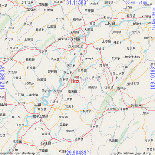
Hezui GPS coordinates[2]
30° 30' 43.092" North, 108° 23' 54.6" East
| Map corner | latitude | longitude |
|---|---|---|
| Upper-left | 31.11583°, | 107.69538° |
| Center: | 30.51197°, | 108.3985° |
| Lower-right: | 29.90433°, | 109.10163° |
| Map W x H: | 134.7×134.7 km | = 83.7×83.7mi |
| max Lat: | 53.31946° ⇑49.6% North |
| Hezui: | 30.51197° |
| min Lat: | ⇓50.4% South 18.22056° |
| min Long | Hezui | max Long |
| 75.07348° | 108.3985° | 134.28917° |
| W 21%⇐ | ⇒79% E |
Elevation
Elevation of Hezui is 650 m = 2133 ft, and this is 165.2 m = 542 ft above average elevation for this country.
| Max E: |
5622 m = 18445 ft | 21.1% |
| Hezui | 650 m 2133 ft | |
| Avg. | 484.8 m = 1591 ft | |
Min E: |
-3 m = -10 ft | 78.9% |
See also: China elevation on elevation.city.
Geographical zone
Hezui is located in North temperate zone (between Tropic of Cancer and the Arctic Circle). Distance of this Northern Tropic circle is 786.7 km =488.8 mi to South.| Distance of | km | miles | from Hezui |
|---|---|---|---|
| North Pole | 6614.4 | 4110 | to North |
| Arctic Circle | 4008.6 | 2490.8 | to North |
| Tropic Cancer | 786.7 | 488.8 | to South |
| Equator | 3392.6 | 2108.1 | to South |


Nearby cities:
15 places around Hezui: (largest is in red/bold)
• Changping
16.3 km =10.1 mi,  241°
241°
• Ganning
20.8 km =12.9 mi,  327°
327°
• Jiannan
15.3 km =9.5 mi,  121°
121°
• Linxi
12.6 km =7.8 mi,  201°
201°
• Longsha
21 km =13 mi,  312°
312°
• Luotian
15.4 km =9.6 mi,  88°
88°
• Rangdu
12.7 km =7.9 mi,  315°
315°
• Wangjia
20.2 km =12.6 mi, 204°
• Wuling
13.4 km =8.3 mi,  267°
267°
• Xikou
12.3 km =7.6 mi, 332°
• Xintian
20.8 km =12.9 mi,  0°
0°
• Xinxiang
12.1 km =7.5 mi,  263°
263°
• Xituo
20.9 km =13 mi, 236°
• Yanshan
9.8 km =6.1 mi,  298°
298°
• Zouma
7.4 km =4.6 mi,  30°
30°
Sources, notices
• [Note1] Compared only with cities in China existing in our database
• [Src1] Map data: © OpenStreetMap contributors (CC-BY-SA)
• [Src2] Other city data from geonames.org with taken over terms of usage.
• [Src3] Geographical zone / Annual Mean Temperature by Robert A. Rohde @ Wikipedia
