Luotian geodata
Luotian (Chongqing) is a seat of a fourth-order administrative division; located in China in Asia/Shanghai (GMT+8) time zone. In our database, there are 1268 cities with bigger population. Compared to other cities in China, 50.5% of cities are located further ↓South; 78.3% of cities are located further →East and 80.4% of cities have lower elevation than Luotian. Note1


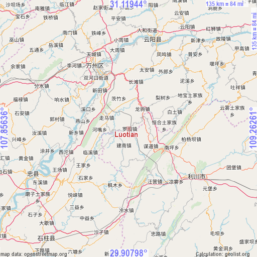
Luotian GPS coordinates[2]
30° 30' 56.16" North, 108° 33' 34.128" East
| Map corner | latitude | longitude |
|---|---|---|
| Upper-left | 31.11944°, | 107.85636° |
| Center: | 30.5156°, | 108.55948° |
| Lower-right: | 29.90798°, | 109.26261° |
| Map W x H: | 134.7×134.7 km | = 83.7×83.7mi |
| max Lat: | 53.31946° ⇑49.5% North |
| Luotian: | 30.5156° |
| min Lat: | ⇓50.5% South 18.22056° |
| min Long | Luotian | max Long |
| 75.07348° | 108.55948° | 134.28917° |
| W 21.7%⇐ | ⇒78.3% E |
Elevation
Elevation of Luotian is 715 m = 2346 ft, and this is 230.2 m = 755 ft above average elevation for this country.
| Max E: |
5622 m = 18445 ft | 19.6% |
| Luotian | 715 m 2346 ft | |
| Avg. | 484.8 m = 1591 ft | |
Min E: |
-3 m = -10 ft | 80.4% |
See also: China elevation on elevation.city.
Geographical zone
Luotian is located in North temperate zone (between Tropic of Cancer and the Arctic Circle). Distance of this Northern Tropic circle is 787.1 km =489.1 mi to South.| Distance of | km | miles | from Luotian |
|---|---|---|---|
| North Pole | 6614 | 4109.7 | to North |
| Arctic Circle | 4008.2 | 2490.6 | to North |
| Tropic Cancer | 787.1 | 489.1 | to South |
| Equator | 3393 | 2108.3 | to South |


Nearby cities:
15 places around Luotian: (largest is in red/bold)
• Baitu
25.8 km =16 mi,  69°
69°
• Changtan
25.2 km =15.7 mi,  8°
8°
• Henghe
18.7 km =11.6 mi,  84°
84°
• Hezui
15.4 km =9.6 mi,  268°
268°
• Jiannan
8.8 km =5.5 mi,  196°
196°
• Linxi
23.4 km =14.5 mi,  238°
238°
• Lishu
24.5 km =15.2 mi,  47°
47°
• Longju
12.8 km =8 mi,  34°
34°
• Moudao
14.5 km =9 mi,  127°
127°
• Nanping
24.4 km =15.2 mi,  112°
112°
• Rangdu
25.8 km =16 mi,  289°
289°
• Xikou
23.6 km =14.7 mi,  296°
296°
• Xintian
25.3 km =15.7 mi,  323°
323°
• Yanshan
24.4 km =15.2 mi,  280°
280°
• Zouma
13.1 km =8.1 mi, 297°
Sources, notices
• [Note1] Compared only with cities in China existing in our database
• [Src1] Map data: © OpenStreetMap contributors (CC-BY-SA)
• [Src2] Other city data from geonames.org with taken over terms of usage.
• [Src3] Geographical zone / Annual Mean Temperature by Robert A. Rohde @ Wikipedia
