Longtan geodata
Longtan (Chongqing) is a seat of a fourth-order administrative division; located in China in Asia/Shanghai (GMT+8) time zone. In our database, there are 1268 cities with bigger population. Compared to other cities in China, 55.9% of cities are located further ↑North; 79.6% of cities are located further →East and 84.4% of cities have lower elevation than Longtan. Note1


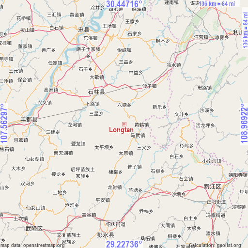
Longtan GPS coordinates[2]
29° 50' 20.832" North, 108° 15' 57.924" East
| Map corner | latitude | longitude |
|---|---|---|
| Upper-left | 30.44716°, | 107.56297° |
| Center: | 29.83912°, | 108.26609° |
| Lower-right: | 29.22736°, | 108.96922° |
| Map W x H: | 135.6×135.6 km | = 84.3×84.3mi |
| max Lat: | 53.31946° ⇑55.9% North |
| Longtan: | 29.83912° |
| min Lat: | ⇓44.1% South 18.22056° |
| min Long | Longtan | max Long |
| 75.07348° | 108.26609° | 134.28917° |
| W 20.4%⇐ | ⇒79.6% E |
Elevation
Elevation of Longtan is 941 m = 3087 ft, and this is 456.2 m = 1497 ft above average elevation for this country.
| Max E: |
5622 m = 18445 ft | 15.6% |
| Longtan | 941 m 3087 ft | |
| Avg. | 484.8 m = 1591 ft | |
Min E: |
-3 m = -10 ft | 84.4% |
See also: China elevation on elevation.city.
Geographical zone
Longtan is located in North temperate zone (between Tropic of Cancer and the Arctic Circle). Distance of this Northern Tropic circle is 711.9 km =442.4 mi to South.| Distance of | km | miles | from Longtan |
|---|---|---|---|
| North Pole | 6689.3 | 4156.5 | to North |
| Arctic Circle | 4083.4 | 2537.3 | to North |
| Tropic Cancer | 711.9 | 442.4 | to South |
| Equator | 3317.8 | 2061.6 | to South |


Nearby cities:
15 places around Longtan: (largest is in red/bold)
• Ditang
26.4 km =16.4 mi,  190°
190°
• Huanghe
9.5 km =5.9 mi,  89°
89°
• Jiangchi
24.5 km =15.2 mi,  289°
289°
• Lianhu
22.6 km =14 mi,  133°
133°
• Liutang
10.4 km =6.5 mi,  5°
5°
• Mawu
9.6 km =6 mi, 127°
• Nanbin
23.4 km =14.5 mi,  319°
319°
• Puzi
23.7 km =14.7 mi,  165°
165°
• Sanxing
16.6 km =10.3 mi, 292°
• Shazi
25 km =15.5 mi,  33°
33°
• Taipingba
16.4 km =10.2 mi,  222°
222°
• Wuping
18.1 km =11.2 mi,  254°
254°
• Xialu
20.9 km =13 mi,  303°
303°
• Xinle
21.7 km =13.5 mi,  63°
63°
• Xixin
15.3 km =9.5 mi,  54°
54°
Sources, notices
• [Note1] Compared only with cities in China existing in our database
• [Src1] Map data: © OpenStreetMap contributors (CC-BY-SA)
• [Src2] Other city data from geonames.org with taken over terms of usage.
• [Src3] Geographical zone / Annual Mean Temperature by Robert A. Rohde @ Wikipedia
