Xialu geodata
Xialu (Chongqing) is a seat of a fourth-order administrative division; located in China in Asia/Shanghai (GMT+8) time zone. In our database, there are 1268 cities with bigger population. Compared to other cities in China, 54.6% of cities are located further ↑North; 80.3% of cities are located further →East and 75.2% of cities have lower elevation than Xialu. Note1


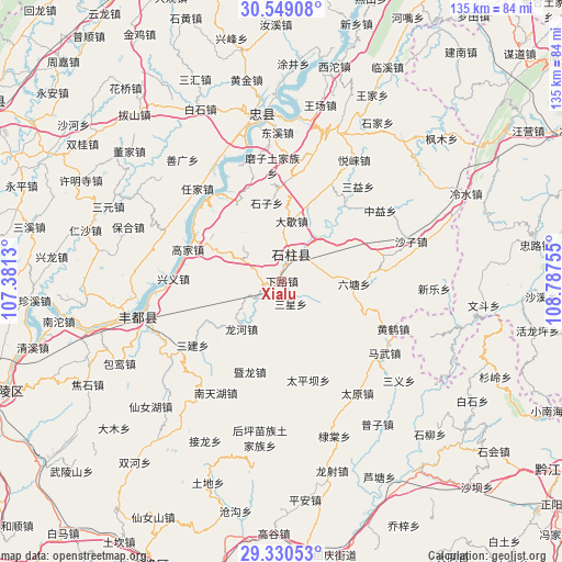
Xialu GPS coordinates[2]
29° 56' 30.012" North, 108° 5' 3.912" East
| Map corner | latitude | longitude |
|---|---|---|
| Upper-left | 30.54908°, | 107.3813° |
| Center: | 29.94167°, | 108.08442° |
| Lower-right: | 29.33053°, | 108.78755° |
| Map W x H: | 135.5×135.5 km | = 84.2×84.2mi |
| max Lat: | 53.31946° ⇑54.6% North |
| Xialu: | 29.94167° |
| min Lat: | ⇓45.4% South 18.22056° |
| min Long | Xialu | max Long |
| 75.07348° | 108.08442° | 134.28917° |
| W 19.7%⇐ | ⇒80.3% E |
Elevation
Elevation of Xialu is 526 m = 1726 ft, and this is 41.2 m = 135 ft above average elevation for this country.
| Max E: |
5622 m = 18445 ft | 24.8% |
| Xialu | 526 m 1726 ft | |
| Avg. | 484.8 m = 1591 ft | |
Min E: |
-3 m = -10 ft | 75.2% |
See also: China elevation on elevation.city.
Geographical zone
Xialu is located in North temperate zone (between Tropic of Cancer and the Arctic Circle). Distance of this Northern Tropic circle is 723.3 km =449.4 mi to South.| Distance of | km | miles | from Xialu |
|---|---|---|---|
| North Pole | 6677.9 | 4149.5 | to North |
| Arctic Circle | 4072 | 2530.2 | to North |
| Tropic Cancer | 723.3 | 449.4 | to South |
| Equator | 3329.2 | 2068.7 | to South |


Nearby cities:
15 places around Xialu: (largest is in red/bold)
• Daxie
14.8 km =9.2 mi,  9°
9°
• Gaojia
23.3 km =14.5 mi,  292°
292°
• Jiangchi
6.3 km =3.9 mi,  240°
240°
• Liutang
18.6 km =11.6 mi,  93°
93°
• Lizi
21.2 km =13.2 mi,  226°
226°
• Longhe
14.9 km =9.3 mi,  220°
220°
• Longkong
19.9 km =12.4 mi,  305°
305°
• Longsha
23.5 km =14.6 mi,  24°
24°
• Longtan
20.9 km =13 mi,  123°
123°
• Nanbin
6.8 km =4.2 mi, 20°
• Qiaotou
25 km =15.5 mi,  41°
41°
• Sanxing
5.5 km =3.4 mi,  155°
155°
• Shizi
19.3 km =12 mi,  349°
349°
• Taipingba
24.4 km =15.2 mi, 164°
• Wuping
16.2 km =10.1 mi,  179°
179°
Sources, notices
• [Note1] Compared only with cities in China existing in our database
• [Src1] Map data: © OpenStreetMap contributors (CC-BY-SA)
• [Src2] Other city data from geonames.org with taken over terms of usage.
• [Src3] Geographical zone / Annual Mean Temperature by Robert A. Rohde @ Wikipedia
