Apengjiang geodata
Apengjiang (Chongqing) is a seat of a fourth-order administrative division; located in China in Asia/Shanghai (GMT+8) time zone. In our database, there are 1268 cities with bigger population. Compared to other cities in China, 63.7% of cities are located further ↑North; 77.5% of cities are located further →East and 70.7% of cities have lower elevation than Apengjiang. Note1


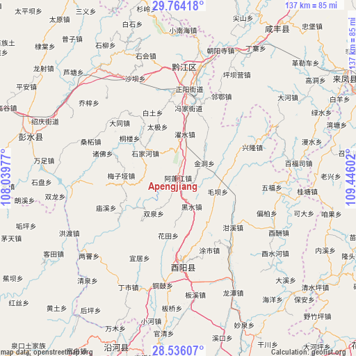
Apengjiang GPS coordinates[2]
29° 9' 7.056" North, 108° 44' 34.404" East
| Map corner | latitude | longitude |
|---|---|---|
| Upper-left | 29.76418°, | 108.03977° |
| Center: | 29.15196°, | 108.74289° |
| Lower-right: | 28.53607°, | 109.44602° |
| Map W x H: | 136.6×136.6 km | = 84.9×84.9mi |
| max Lat: | 53.31946° ⇑63.7% North |
| Apengjiang: | 29.15196° |
| min Lat: | ⇓36.3% South 18.22056° |
| min Long | Apengjiang | max Long |
| 75.07348° | 108.74289° | 134.28917° |
| W 22.5%⇐ | ⇒77.5% E |
Elevation
Elevation of Apengjiang is 425 m = 1394 ft, and this is 59.8 m = 196 ft below average elevation for this country.
| Max E: |
5622 m = 18445 ft | 29.3% |
| Avg. | 484.8 m = 1591 ft | |
| Apengjiang | 425 m = 1394 ft | |
Min E: |
-3 m = -10 ft | 70.7% |
See also: China elevation on elevation.city.
Geographical zone
Apengjiang is located in North temperate zone (between Tropic of Cancer and the Arctic Circle). Distance of this Northern Tropic circle is 635.5 km =394.9 mi to South.| Distance of | km | miles | from Apengjiang |
|---|---|---|---|
| North Pole | 6765.7 | 4204 | to North |
| Arctic Circle | 4159.8 | 2584.8 | to North |
| Tropic Cancer | 635.5 | 394.9 | to South |
| Equator | 3241.4 | 2014.1 | to South |


Nearby cities:
15 places around Apengjiang: (largest is in red/bold)
• Cangling
21.8 km =13.5 mi,  219°
219°
• Daji
21.2 km =13.2 mi,  338°
338°
• Echi
14.9 km =9.3 mi,  264°
264°
• Heishui
11.9 km =7.4 mi,  154°
154°
• Huatian
22.3 km =13.9 mi,  189°
189°
• Jindong
11.6 km =7.2 mi,  60°
60°
• Langping
20.7 km =12.9 mi,  247°
247°
• Mala
17.9 km =11.1 mi,  35°
35°
• Maoba
16.1 km =10 mi,  108°
108°
• Meiziya
21.8 km =13.5 mi,  272°
272°
• Shijia
15.8 km =9.8 mi,  306°
306°
• Shuangquan
16.5 km =10.3 mi,  214°
214°
• Shuishi
11.1 km =6.9 mi, 337°
• Xinhua
23.4 km =14.5 mi,  324°
324°
• Zhuoshui
17 km =10.6 mi,  8°
8°
Sources, notices
• [Note1] Compared only with cities in China existing in our database
• [Src1] Map data: © OpenStreetMap contributors (CC-BY-SA)
• [Src2] Other city data from geonames.org with taken over terms of usage.
• [Src3] Geographical zone / Annual Mean Temperature by Robert A. Rohde @ Wikipedia
