Xinkaihe geodata
Xinkaihe (Tianjin) is a seat of a fourth-order administrative division; located in China in Asia/Shanghai (GMT+8) time zone. In our database, there are 1268 cities with bigger population. Compared to other cities in China, 83.6% of cities are located further ↓South; 67% of cities are located further ←West and 97.2% of cities have higher elevation than Xinkaihe. Note1


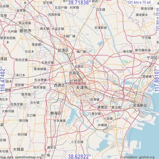
Xinkaihe GPS coordinates[2]
39° 10' 31.44" North, 117° 10' 40.584" East
| Map corner | latitude | longitude |
|---|---|---|
| Upper-left | 39.71836°, | 116.47482° |
| Center: | 39.1754°, | 117.17794° |
| Lower-right: | 38.62822°, | 117.88107° |
| Map W x H: | 121.2×121.2 km | = 75.3×75.3mi |
| max Lat: | 53.31946° ⇑16.4% North |
| Xinkaihe: | 39.1754° |
| min Lat: | ⇓83.6% South 18.22056° |
| min Long | Xinkaihe | max Long |
| 75.07348° | 117.17794° | 134.28917° |
| W 67%⇐ | ⇒33% E |
Elevation
Elevation of Xinkaihe is 5 m = 16 ft, and this is 479.8 m = 1574 ft below average elevation for this country.
| Max E: |
5622 m = 18445 ft | 97.2% |
| Avg. | 484.8 m = 1591 ft | |
| Xinkaihe | 5 m = 16 ft | |
Min E: |
-3 m = -10 ft | 2.8% |
See also: China elevation on elevation.city.
Geographical zone
Xinkaihe is located in North temperate zone (between Tropic of Cancer and the Arctic Circle). Distance of this Northern Tropic circle is 1750 km =1087.4 mi to South.| Distance of | km | miles | from Xinkaihe |
|---|---|---|---|
| North Pole | 5651.2 | 3511.5 | to North |
| Arctic Circle | 3045.3 | 1892.3 | to North |
| Tropic Cancer | 1750 | 1087.4 | to South |
| Equator | 4355.9 | 2706.6 | to South |


Nearby cities:
15 places around Xinkaihe: (largest is in red/bold)
• Dahutong
3.3 km =2.1 mi,  174°
174°
• Dingzigu
1.8 km =1.1 mi,  265°
265°
• Guangfudao
3.8 km =2.4 mi,  148°
148°
• Hongshunli
2.2 km =1.4 mi,  156°
156°
• Jianchangdao
3.9 km =2.4 mi,  100°
100°
• Ningyuan
3 km =1.9 mi,  116°
116°
• Santiaoshi
2.2 km =1.4 mi,  185°
185°
• Shaogongzhuang
3 km =1.9 mi,  221°
221°
• Tianjin
3.7 km =2.3 mi,  181°
181°
• Tiedonglu
2.4 km =1.5 mi,  46°
46°
• Wanghailou
2.8 km =1.7 mi,  128°
128°
• Xianyang Beilu
3.4 km =2.1 mi,  286°
286°
• Xigu
1.4 km =0.9 mi,  213°
213°
• Xiyuzhuang
2.1 km =1.3 mi,  240°
240°
• Yixingfu
3.9 km =2.4 mi, 47°
Sources, notices
• [Note1] Compared only with cities in China existing in our database
• [Src1] Map data: © OpenStreetMap contributors (CC-BY-SA)
• [Src2] Other city data from geonames.org with taken over terms of usage.
• [Src3] Geographical zone / Annual Mean Temperature by Robert A. Rohde @ Wikipedia
