Longtanzi geodata
Longtanzi (Chongqing) is a seat of a fourth-order administrative division; located in China in Asia/Shanghai (GMT+8) time zone. In our database, there are 1268 cities with bigger population. Compared to other cities in China, 59.7% of cities are located further ↑North; 87.5% of cities are located further →East and 69% of cities have lower elevation than Longtanzi. Note1


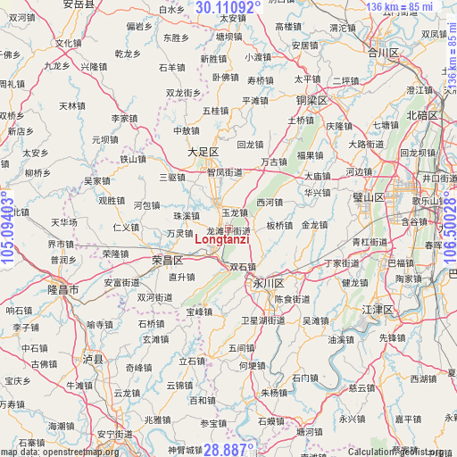
Longtanzi GPS coordinates[2]
29° 30' 2.916" North, 105° 47' 49.74" East
| Map corner | latitude | longitude |
|---|---|---|
| Upper-left | 30.11092°, | 105.09403° |
| Center: | 29.50081°, | 105.79715° |
| Lower-right: | 28.887°, | 106.50028° |
| Map W x H: | 136.1×136.1 km | = 84.6×84.6mi |
| max Lat: | 53.31946° ⇑59.7% North |
| Longtanzi: | 29.50081° |
| min Lat: | ⇓40.3% South 18.22056° |
| min Long | Longtanzi | max Long |
| 75.07348° | 105.79715° | 134.28917° |
| W 12.5%⇐ | ⇒87.5% E |
Elevation
Elevation of Longtanzi is 392 m = 1286 ft, and this is 92.8 m = 304 ft below average elevation for this country.
| Max E: |
5622 m = 18445 ft | 31% |
| Avg. | 484.8 m = 1591 ft | |
| Longtanzi | 392 m = 1286 ft | |
Min E: |
-3 m = -10 ft | 69% |
See also: China elevation on elevation.city.
Geographical zone
Longtanzi is located in North temperate zone (between Tropic of Cancer and the Arctic Circle). Distance of this Northern Tropic circle is 674.3 km =419 mi to South.| Distance of | km | miles | from Longtanzi |
|---|---|---|---|
| North Pole | 6726.9 | 4179.9 | to North |
| Arctic Circle | 4121 | 2560.7 | to North |
| Tropic Cancer | 674.3 | 419 | to South |
| Equator | 3280.2 | 2038.2 | to South |


Nearby cities:
15 places around Longtanzi: (largest is in red/bold)
• Banqiao
15.2 km =9.4 mi,  84°
84°
• Baoxing
16.8 km =10.4 mi,  323°
323°
• Fenggao
14.4 km =8.9 mi,  235°
235°
• Longshui
8 km =5 mi,  334°
334°
• Sanjiao
7 km =4.3 mi,  101°
101°
• Shima
14.9 km =9.3 mi,  12°
12°
• Shiwan
15.8 km =9.8 mi,  36°
36°
• Shuanglu
3.7 km =2.3 mi, 242°
• Shuangshi
11.8 km =7.3 mi,  160°
160°
• Tongqiao
3.7 km =2.3 mi,  308°
308°
• Xihe
14.6 km =9.1 mi,  56°
56°
• Youting
9.6 km =6 mi,  216°
216°
• Yulong
5.2 km =3.2 mi, 14°
• Zhifeng
17.1 km =10.6 mi,  355°
355°
• Zhuxi
13.2 km =8.2 mi,  287°
287°
Sources, notices
• [Note1] Compared only with cities in China existing in our database
• [Src1] Map data: © OpenStreetMap contributors (CC-BY-SA)
• [Src2] Other city data from geonames.org with taken over terms of usage.
• [Src3] Geographical zone / Annual Mean Temperature by Robert A. Rohde @ Wikipedia
