Dula’er Ewenke Minzu geodata
Dula’er Ewenke Minzu (Inner Mongolia) is a seat of a fourth-order administrative division; located in China in Asia/Shanghai (GMT+8) time zone. In our database, there are 1268 cities with bigger population. Compared to other cities in China, 99% of cities are located further ↓South; 93.6% of cities are located further ←West and 59.5% of cities have lower elevation than Dula’er Ewenke Minzu. Note1


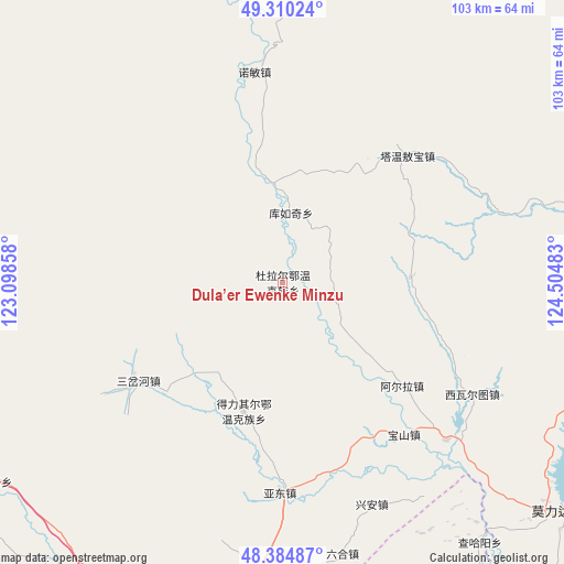
Dula’er Ewenke Minzu GPS coordinates[2]
48° 50' 58.884" North, 123° 48' 6.12" East
| Map corner | latitude | longitude |
|---|---|---|
| Upper-left | 49.31024°, | 123.09858° |
| Center: | 48.84969°, | 123.8017° |
| Lower-right: | 48.38487°, | 124.50483° |
| Map W x H: | 102.9×102.9 km | = 63.9×63.9mi |
| max Lat: | 53.31946° ⇑1% North |
| Dula’er Ewenke Minzu: | 48.84969° |
| min Lat: | ⇓99% South 18.22056° |
| min Long | Dula’er Ewenk | max Long |
| 75.07348° | 123.8017° | 134.28917° |
| W 93.6%⇐ | ⇒6.4% E |
Elevation
Elevation of Dula’er Ewenke Minzu is 253 m = 830 ft, and this is 231.8 m = 760 ft below average elevation for this country.
| Max E: |
5622 m = 18445 ft | 40.5% |
| Avg. | 484.8 m = 1591 ft | |
| Dula’er Ewenke Minzu | 253 m = 830 ft | |
Min E: |
-3 m = -10 ft | 59.5% |
See also: China elevation on elevation.city.
Geographical zone
Dula’er Ewenke Minzu is located in North temperate zone (between Tropic of Cancer and the Arctic Circle). Distance of this North polar circle is 1969.6 km =1223.9 mi to North.| Distance of | km | miles | from Dula’er Ewenke Minzu |
|---|---|---|---|
| North Pole | 4575.5 | 2843.1 | to North |
| Arctic Circle | 1969.6 | 1223.9 | to North |
| Tropic Cancer | 2825.7 | 1755.8 | to South |
| Equator | 5431.6 | 3375 | to South |


Nearby cities:
15 places around Dula’er Ewenke Minzu: (largest is in red/bold)
• A’erla
28.9 km =18 mi,  130°
130°
• Baoshan
35.5 km =22.1 mi,  141°
141°
• Deliqi’er
24.6 km =15.3 mi,  194°
194°
• Gushan
57.7 km =35.9 mi,  182°
182°
• Kunmi Erdi
23.5 km =14.6 mi,  87°
87°
• Kuruqi
12.7 km =7.9 mi,  6°
6°
• Liuhe
50.9 km =31.6 mi,  167°
167°
• Nuomin
38.8 km =24.1 mi,  352°
352°
• Sanchahe
31.8 km =19.8 mi,  235°
235°
• Taipingzhuang
47 km =29.2 mi,  197°
197°
• Tawen Aobao
32.4 km =20.1 mi,  44°
44°
• Woluohe
53.9 km =33.5 mi,  18°
18°
• Wu’erke
50.2 km =31.2 mi, 134°
• Xiwa’ertu
39.9 km =24.8 mi,  120°
120°
• Yadong
38.6 km =24 mi, 182°
Sources, notices
• [Note1] Compared only with cities in China existing in our database
• [Src1] Map data: © OpenStreetMap contributors (CC-BY-SA)
• [Src2] Other city data from geonames.org with taken over terms of usage.
• [Src3] Geographical zone / Annual Mean Temperature by Robert A. Rohde @ Wikipedia
