Taipingzhuang geodata
Taipingzhuang (Inner Mongolia) is a seat of a fourth-order administrative division; located in China in Asia/Shanghai (GMT+8) time zone. In our database, there are 1268 cities with bigger population. Compared to other cities in China, 98.9% of cities are located further ↓South; 93.4% of cities are located further ←West and 61.7% of cities have lower elevation than Taipingzhuang. Note1


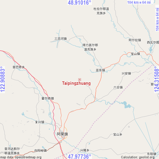
Taipingzhuang GPS coordinates[2]
48° 26' 45.24" North, 123° 36' 43.02" East
| Map corner | latitude | longitude |
|---|---|---|
| Upper-left | 48.91016°, | 122.90883° |
| Center: | 48.4459°, | 123.61195° |
| Lower-right: | 47.97736°, | 124.31508° |
| Map W x H: | 103.7×103.7 km | = 64.4×64.4mi |
| max Lat: | 53.31946° ⇑1.1% North |
| Taipingzhuang: | 48.4459° |
| min Lat: | ⇓98.9% South 18.22056° |
| min Long | Taipingzhuang | max Long |
| 75.07348° | 123.61195° | 134.28917° |
| W 93.4%⇐ | ⇒6.6% E |
Elevation
Elevation of Taipingzhuang is 279 m = 915 ft, and this is 205.8 m = 675 ft below average elevation for this country.
| Max E: |
5622 m = 18445 ft | 38.3% |
| Avg. | 484.8 m = 1591 ft | |
| Taipingzhuang | 279 m = 915 ft | |
Min E: |
-3 m = -10 ft | 61.7% |
See also: China elevation on elevation.city.
Geographical zone
Taipingzhuang is located in North temperate zone (between Tropic of Cancer and the Arctic Circle). Distance of this North polar circle is 2014.5 km =1251.8 mi to North.| Distance of | km | miles | from Taipingzhuang |
|---|---|---|---|
| North Pole | 4620.4 | 2871 | to North |
| Arctic Circle | 2014.5 | 1251.8 | to North |
| Tropic Cancer | 2780.8 | 1727.9 | to South |
| Equator | 5386.7 | 3347.1 | to South |


Nearby cities:
15 places around Taipingzhuang: (largest is in red/bold)
• A’erla
44.4 km =27.6 mi,  54°
54°
• Baoshan
40 km =24.9 mi,  64°
64°
• Baoshan
43.1 km =26.8 mi,  145°
145°
• Deliqi’er
22.5 km =14 mi,  20°
20°
• Dula’er Ewenke Minzu
47 km =29.2 mi, 17°
• Fuxing
38 km =23.6 mi,  223°
223°
• Gushan
17.2 km =10.7 mi,  137°
137°
• Honghualiangzi
45.8 km =28.5 mi, 216°
• Huo’erqi
24.3 km =15.1 mi,  240°
240°
• Liuhe
25.2 km =15.7 mi,  101°
101°
• Naji
37.7 km =23.4 mi,  197°
197°
• Naketa
30.1 km =18.7 mi,  260°
260°
• Sanchahe
29.7 km =18.5 mi,  335°
335°
• Xinglong
46.2 km =28.7 mi,  175°
175°
• Yadong
14.1 km =8.8 mi, 63°
Sources, notices
• [Note1] Compared only with cities in China existing in our database
• [Src1] Map data: © OpenStreetMap contributors (CC-BY-SA)
• [Src2] Other city data from geonames.org with taken over terms of usage.
• [Src3] Geographical zone / Annual Mean Temperature by Robert A. Rohde @ Wikipedia
