Xibusha geodata
Xibusha (Qinghai) is a seat of a fourth-order administrative division; located in China in Asia/Shanghai (GMT+8) time zone. In our database, there are 1268 cities with bigger population. Compared to other cities in China, 75.1% of cities are located further ↓South; 93.2% of cities are located further →East and 97.9% of cities have lower elevation than Xibusha. Note1


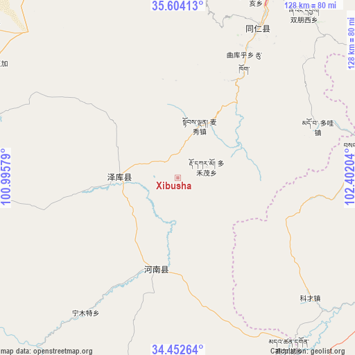
Xibusha GPS coordinates[2]
35° 1' 49.476" North, 101° 41' 56.076" East
| Map corner | latitude | longitude |
|---|---|---|
| Upper-left | 35.60413°, | 100.99579° |
| Center: | 35.03041°, | 101.69891° |
| Lower-right: | 34.45264°, | 102.40204° |
| Map W x H: | 128×128 km | = 79.5×79.5mi |
| max Lat: | 53.31946° ⇑24.9% North |
| Xibusha: | 35.03041° |
| min Lat: | ⇓75.1% South 18.22056° |
| min Long | Xibusha | max Long |
| 75.07348° | 101.69891° | 134.28917° |
| W 6.8%⇐ | ⇒93.2% E |
Elevation
Elevation of Xibusha is 3629 m = 11906 ft, and this is 3144.2 m = 10316 ft above average elevation for this country.
| Max E: |
5622 m = 18445 ft | 2.1% |
| Xibusha | 3629 m 11906 ft | |
| Avg. | 484.8 m = 1591 ft | |
Min E: |
-3 m = -10 ft | 97.9% |
See also: China elevation on elevation.city.
Geographical zone
Xibusha is located in North temperate zone (between Tropic of Cancer and the Arctic Circle). Distance of this Northern Tropic circle is 1289.1 km =801 mi to South.| Distance of | km | miles | from Xibusha |
|---|---|---|---|
| North Pole | 6112 | 3797.8 | to North |
| Arctic Circle | 3506.2 | 2178.7 | to North |
| Tropic Cancer | 1289.1 | 801 | to South |
| Equator | 3895 | 2420.2 | to South |


Nearby cities:
15 places around Xibusha: (largest is in red/bold)
• Dogarmo
11.1 km =6.9 mi,  68°
68°
• Duofudu
20.5 km =12.7 mi,  22°
22°
• Duowa
53.3 km =33.1 mi, 69°
• Jiawu
60.3 km =37.5 mi,  31°
31°
• Nianduhu
63.1 km =39.2 mi, 27°
• Ningmute
58.9 km =36.6 mi,  214°
214°
• Qiakeri
20.7 km =12.9 mi,  273°
273°
• Qukuhu
48.3 km =30 mi, 29°
• Rongwo
61.1 km =38 mi, 28°
• Sangke
38.2 km =23.7 mi,  77°
77°
• Sangke
68.6 km =42.6 mi, 81°
• Tuoyema
50.3 km =31.3 mi,  197°
197°
• Yalang
56.4 km =35 mi, 23°
• Youganning
33.7 km =20.9 mi,  193°
193°
• Zhamao
39.4 km =24.5 mi, 27°
Sources, notices
• [Note1] Compared only with cities in China existing in our database
• [Src1] Map data: © OpenStreetMap contributors (CC-BY-SA)
• [Src2] Other city data from geonames.org with taken over terms of usage.
• [Src3] Geographical zone / Annual Mean Temperature by Robert A. Rohde @ Wikipedia
